Roger J. Wendell
Defending 3.8 Billion Years of Organic EvolutionSM

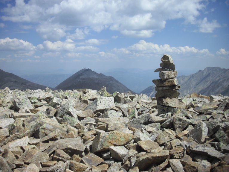
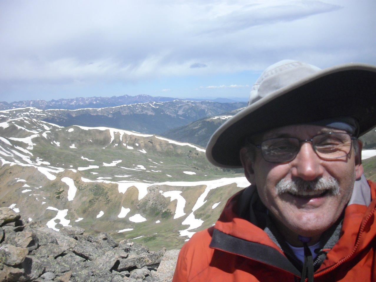
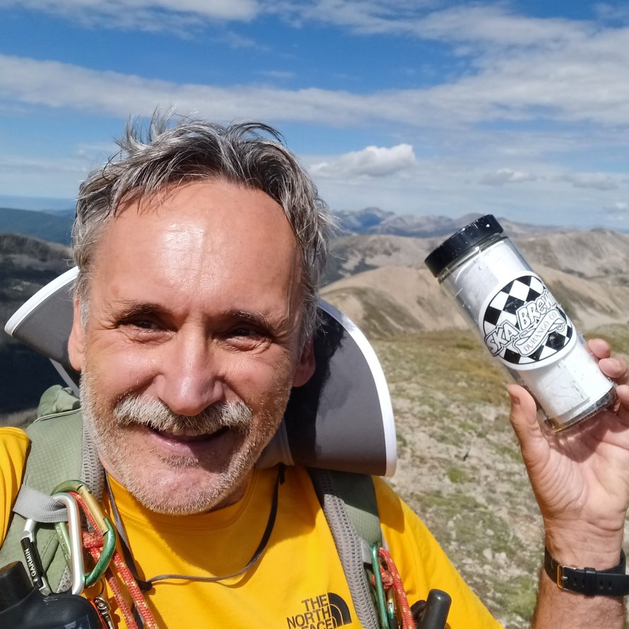
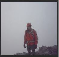
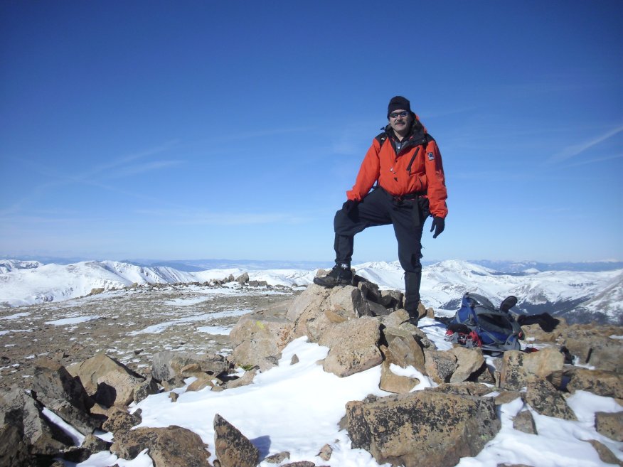
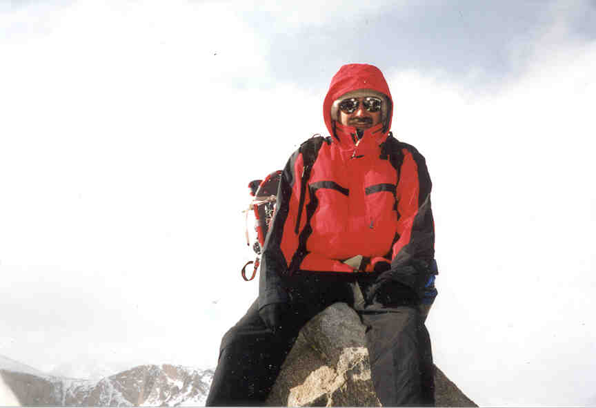
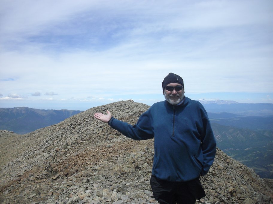
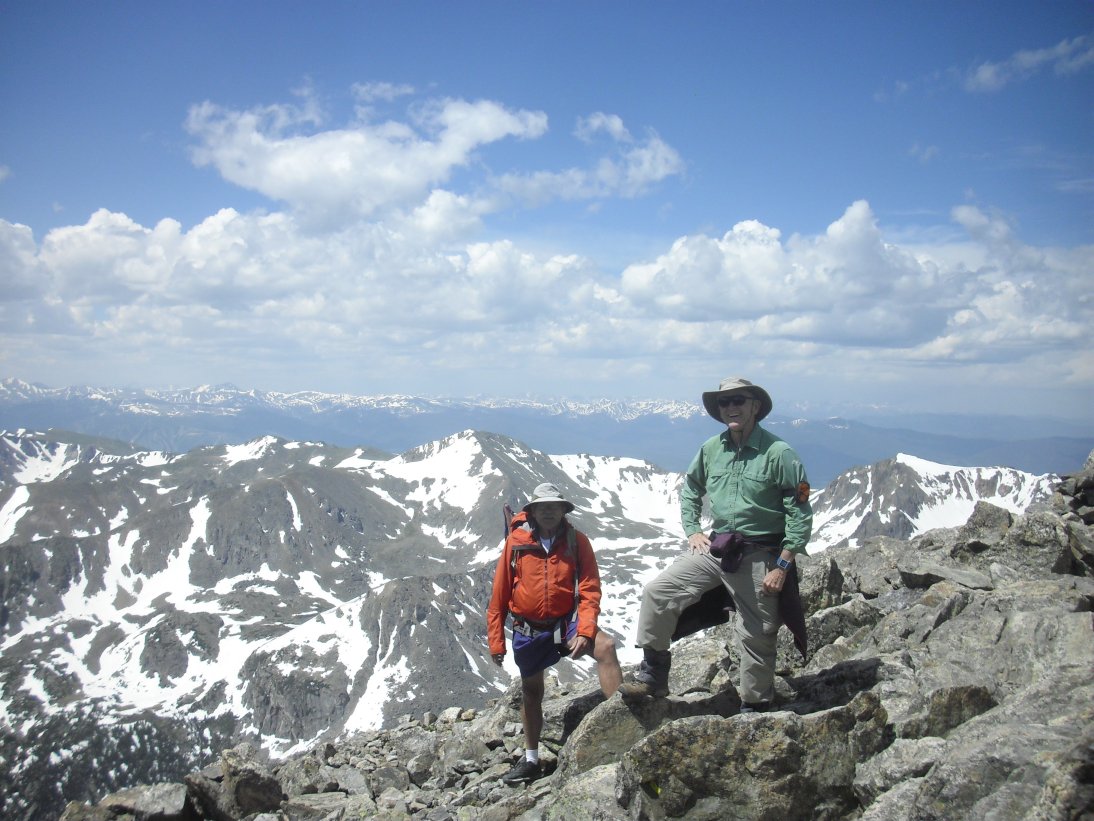
Wheeler Peak, New Mexico - 4,011 metres (13,161 feet)
(note the antenna/transmitter in my right hand for remote camera control)Thoughts, notes, and pictures that relate to peaks between 3,962 and 4,267 metres (12,999 and 14,000 feet) in
height around my favorite state, Colorado, and other interesting places in neighboring states and around the world!
(Also referred to as "Thirteeners!")
NOTE: LIDAR (Light Detection and Ranging) was put into use many decades after I started hiking and climbing. LIDAR is a more accurate way of measuring the Earth's surface and, as such, has changed what was believed to be the elevation of many mountains and highpoints. As a result, the "prominence" (at least 300 feet above a connecting saddle) of many mountains has changed along with their elevations. A personal example, for me, is Republican Mountain - a previously "unranked" 12er near Silver Plume that I climbed in 2022 after learning that LIDAR had determined it now had 312 feet of prominence. Peak 8, near Breckenridge is another personal example of change brought on by LIDAR. When I originally climbed Peak 8 I believed it to be a 12er, only to learn later that it's actual elevation is 13,005 feet! So, in summary, many of the elevations you see on my pages may not (yet) be accurate - requiring an update someday in the future as time permits!
|
|
Click Here for my 14ers page... |
|
|
Click Here for my 12ers page... |

|
Click Here for the Ten Essentials - Don't leave home without 'em! |
|
|
Click Here for my page on highpoints... |
|
|
Click Here for my general notes Climbing and Mountaineering. |
|
|
Click Here for other peaks and mountaintops that I've summited... |
Ranked or Unranked?
The most popular climbs, in Colorado, are the "14ers" - mountains over 14,000 feet high. The problem is they're used so much, by so many, that most of the trails are deeply worn and solitude that much less frequent. So, many of us "locals" (because we have easy, regular access that visitors can't make time for) enjoy the less lofty pursuit of 13ers - peaks at 13,000 feet (3,962 metres), or higher, but less than 14,000 feet (4,267 metres). There are about 584 "official," or "ranked" (at least 300 feet of prominence) 13ers throughout Colorado - they're much less popular than the 58 ranked/unranked "big ones" (14ers) but provide plenty of solitude while giving you an equally great climb! Although the 300 foot (91.44 metres) "saddle rule" (Also known as "prominence," "saddle depth," or "rank") generaly applies to all of Colorado's mountains, there seems to be some flexibility in the 3,000 foot (914.4 metres) ascent requirement. This may be due to the approach, or start, being a bit closer to some of the 13er summits for obvious reasons. Admittedly these criteria are fairly arbitrary, but, the "line" has to be drawn somewhere so I think these measurements are closest to representing what it means to be a mountain in Colorado and around the American west (Alaska having exceptions of its own...)
Oh, and don't be fooled! Some of Colorado's 13ers have some of the most difficult "standard" routes in the state - peaks like Lizard Head, Jagged, Dallas and one or two others are examples that quickly come to mind - peaks with a bit of 5th class and tough route-finding where you'd better know what you're doing!Finally, some of Colorado's neighboring states, and near-neighbors (California, New Mexico, Utah, Wyoming), have a number of 13ers of their own that can be fun and challenging at times as well. No matter the location, be sure to incorporate safety into your hiking or climbing plans - mountaineering has been fun and rewarding for me but I've seen more than my share of accidents and mishaps over the years...
My list of Colorado 13ers, so far:
|
|
Other 13ers I've climbed outside my home state of Colorado:
- Bolivia - Cernoke (Full of antennas on top) 4,175 meters (13,697 feet) - June 11, 2013
- Bolivia - Cerro Calvario (Calvary Hill) 3,972 meters (13,031 feet) - June 10, 2013
- California - Montgomery Peak 4,097 metres (13,441 feet) - August 03, 2011
- Hawai'i - Mauna Kea 4,205 metres (13,796 feet) - February 13, 2007 [Although I don't take the statistic too seriously, Mauna Kea is considered the world's highest mountain as measured from its base (32,000 to 33,000 feet, or about 10,000 metres)]
- Malaysia - Kinabalu, Mount (Gunung Kinabalu) 4,095 metres (13,435 feet) - December 10, 2014 [with Steve Bonowski, Tom Cope, and Patrick Thornley]
- Nevada - Boundary Peak 4,005 metres (13,140 feet) - August 03, 2011
- New Mexico - Wheeler Peak 4,011 metres (13,161 feet) - June 10, 2011
- Utah - Kings Peak 4,123 metres (13,528 feet) - September 22, 2011 (...had the entire mountain to myself for over a day!)
Unranked Sub Peaks: (13er Points of interest that I've climbed that don't have enough topographic prominence to be considered a peak of their own...)
- Arapaho Peak, South, Colorado (13,397 ft) - June 15, 2018 Front Range [with Bob Huey]
- Bancroft, Mount, Colorado (13,262 ft) - August 01, 2022 James Peak Wilderness [while on Jeff Stevens' CMC climb]
- Chiquita, Mount (13,054 ft) - August 05, 2023 [with Bob Huey. I did CCY this date]
- Frasco Benchmark, Colorado (13,876 ft) - August 25, 2012 Sawatch Range [while on Joe Schultes' CMC climb]
- Gemini Peak (13,951 ft) - July 20, 1997 [Ken Yarcho's CMC lead]
- Igloo Peak (13,500 ft), Sawatch Range - August 19, 2023 [Same day that I did UN 13500 and Twining Peak - I repeated Igloo Peak two weeks later on 09-02-2023]
- Iron Nipple (13,500 ft) - September 18, 2022 [On my way to Huerfano Peak where I met up with Jim Siebarth again]
- K2, Colorado (13,664 ft) - August 09, 2009 Elks Range
- Kuss Peak aka "Repeater Peak" (13,560 ft) Lake and Park counties, Colorado - July 03, 2016 [My CMC lead and then again on Abbie Gentry's CMC lead on 08-10-2024]
- Loveland Mountain, Mosquito Range, Colorado (13,692) - August 16, 2014
- Peerless Mountain, Colorado (13,348 ft) - May 25, 2013 Tenmile-Mosquito Range [while on Steve Bonowski's CMC climb up Horseshoe]
- Point 13,660, Colorado (13,660 ft) Sawatch Range - October 22, 2011 [I was the LIT for John Collard's CMC climb]
- Point 13,832, Colorado (13,832 ft) Elks Range - July 22, 2007 [with Aidan McGuire]
- Point 13,930, Colorado (13,930 ft) Sawatch Range - August 26, 2007 [with John Aldag]
- Spalding Mountain, Colorado (13,846 ft) - June 25, 2000 [with Doug Bloom]
- Sullivan Mountain, Colorado (13,134 ft) - August 29, 2015 [with Claude Neumann]
- Treasurevault Mountain (13,706 feet) Lake and Park counties, Colorado. With Abbie Gentry's CMC group on 08-10-2024
- Walter, Mount (13,141 feet / 4,005 metres) New Mexico - on the same massive as Wheeler Peak but only a few tens of metres away from it with 53 feet of prominence
- Wheeler Peak 3,982 metres (13,063 feet) Nevada - August 04, 2011
- White Ridge (13,684 ft) - July 20, 1997 [Ken Yarcho's CMC lead]
Centennials

This list of "13ers," combined with the 14ers (listed on my other page), comprise the Colorado Centennials - the highest 100 peaks in Colorado! Note: The summits shown in gray do not have enough prominence to be a ranked peak. Those shown in "quotes" were not officially named by the USGS at the time I created this entry. Also, LIDAR has changed some of this data - I'll update the list of peaks as time permits!
|
|
Click on any of this page's "thumbnail" images for a larger view!
French Mountain, Casco Peak, and Frasco Benchmark
Led by Joe Shultes, this was a CMC trip on August 25, 2012 that took us up two Centennials (French is 13,940 feet and Casco is 13,908 feet) and the unranked Frasco Benchmark (13,867 feet).
 French Mountain |
 French Mountain glass register |
 Cascp Peak |
 Casco Peak |
 Frasco Benchmark |
 Frasco Benchmark |
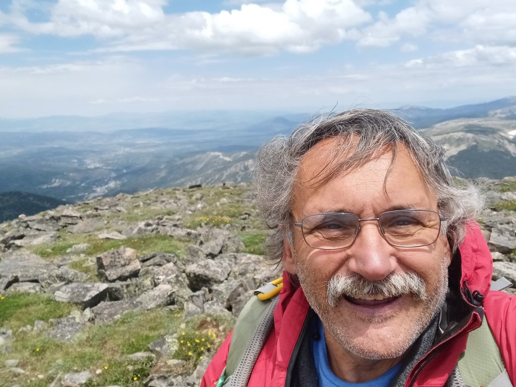
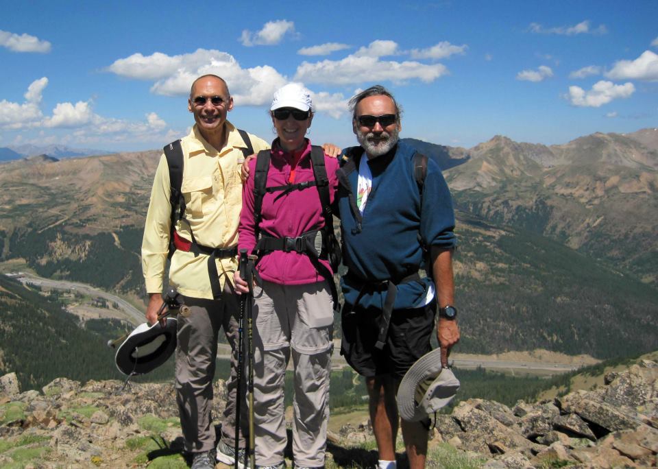
Mount Ouray, Colorado (13,971 feet / 4,258 metres)
Mount Ouray is located in Colorado's southern Sawatch Range, in the San Isabel National Forest, Chaffee County. It's considered a Colorado "Centennial" since it's one of the state's highest 100 peaks. For this climb I was a Leader-in-Training for a Colorado Mountain Club outing organized by Candace. Accompanying us this early fall day were Eileen and Jay. The weather was mostly overcast, fog, and some sporadic pelting snow at times. But, as you can see from the shots below, there were a few minutes where the sky temporarily cleared to afford us some better views!
 1. Mount Ouray summit |
 2. Jay at the summit cairn |
 3. Me, Candace, and Eileen |
 4. Frost on the ridge |
 1. Coming back down... |
 1. Fall leaves near the trailhead |
|
|
Click Here for my YouTube video on top Mount Ouray... |
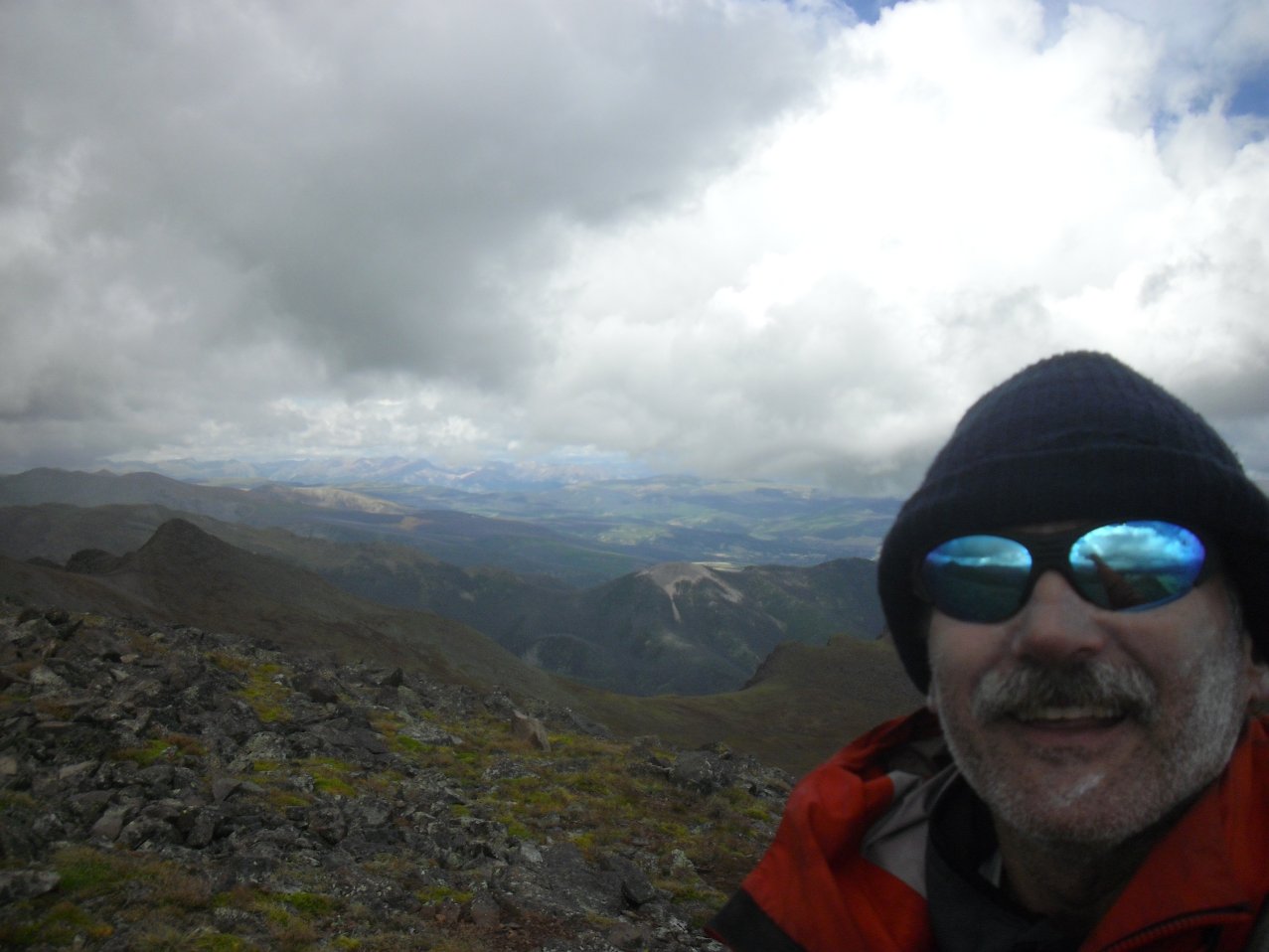
Kings Peak, Utah (13,528 feet /4,123 metres)
Kings Peak is the highest point in Utah and is located in the Uinta Wilderness area of the Ashley National Forest in thenortheastern part of the state. I had the pleasure of climbing Kings Peak in late fall when the leaves were just starting to turn and I had the mountain entirely to myself (everyone was at work or in school!)! At about 30 miles (48 kilometres) roundtrip Kings Peak can be completed in one long, hard day hike from the Henry's Fork trailhead. I, however, chose to break the climb up into two overnight camps so that I could enjoy the area before winter set in. A drive through southern Wyoming is required to reach the trailhead where I spent the night sleeping near my car as it was too dark to figure out where the campsites were! Once on the trail I made way quickly and was able to set up "high camp" at about 11,000 feet (3,300 metres). From there it only took about three hours to reach the summit where I was able to enjoy beautiful weather and solitude. Unfortunately, as you can see from one of the photos, there was a bit of junk being stored on the summit where a register would normally be located. Memorials, religious materials, "geocaching" and even summit registers have no place in our nation's wilderness areas - even if the "storage" spot is on a peak. Anyway, I was able to casually make my way back down to camp after having enjoyed a couple hours of very comfortable "summit time" - I'm very lucky!
 1. Frosty car camping... |
 2. High camp... |
 3. Summit from Henry's Fork Basin |
 4. kings Peak Summit |
 6. Me on the summit! |
 6. Junk on the summit... |
|
|
Click Here for my YouTube video on top of Kings Peak... |
|
|
Click Here for my YouTube video at Gunsight Pass on the way to Kings Peak... |
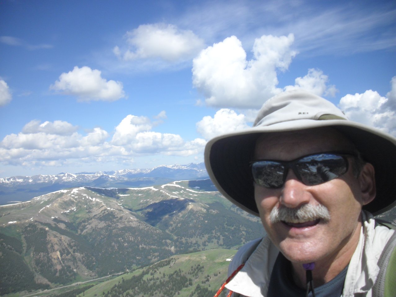
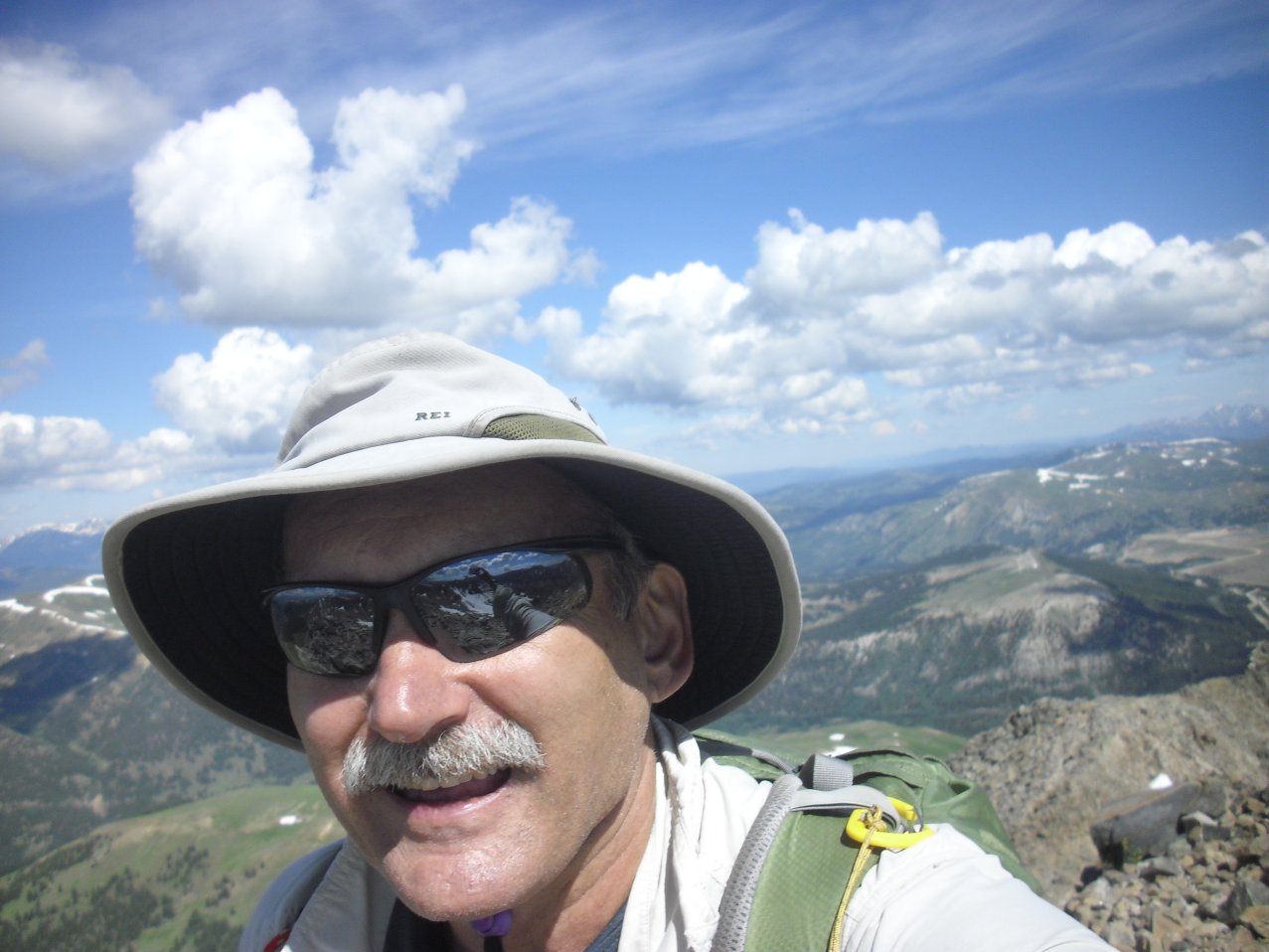
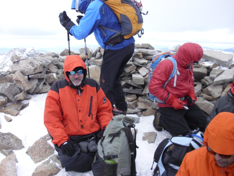
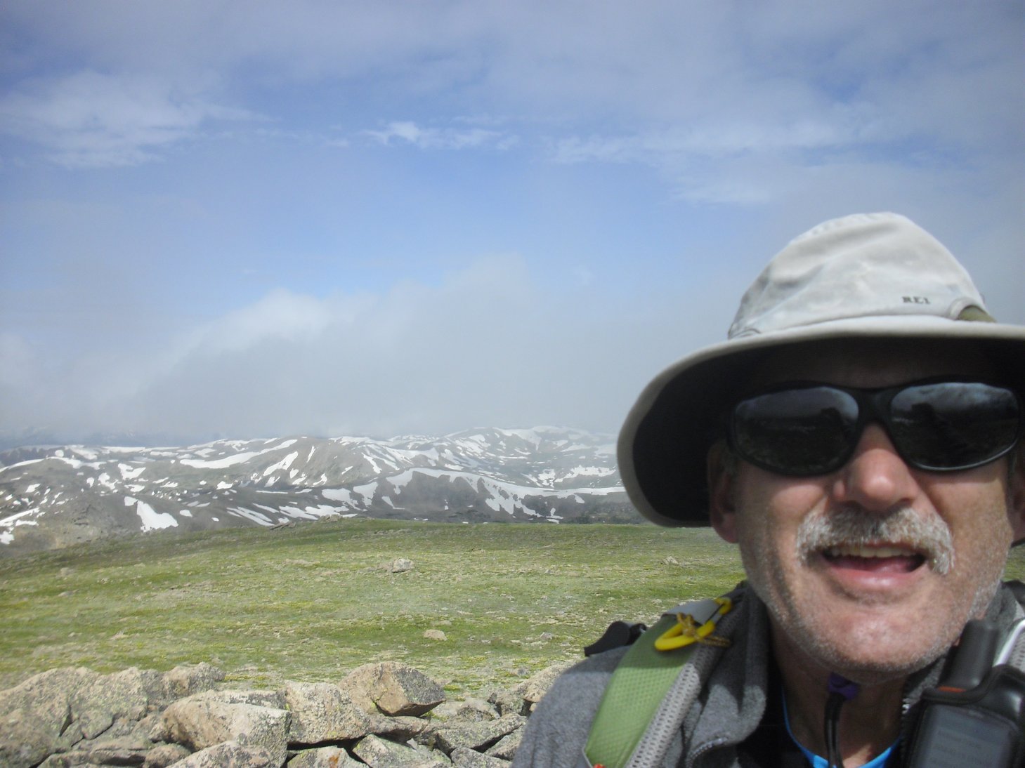
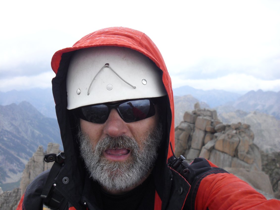
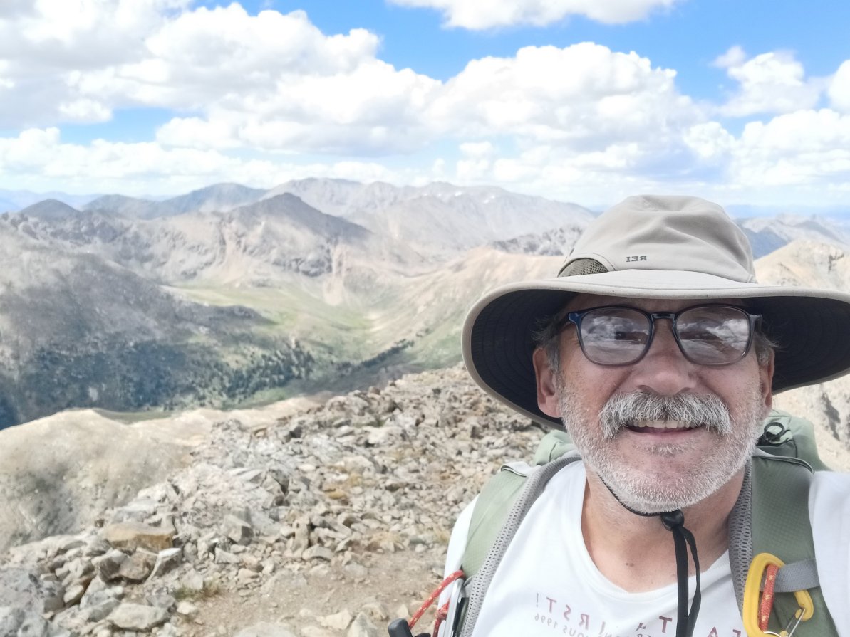
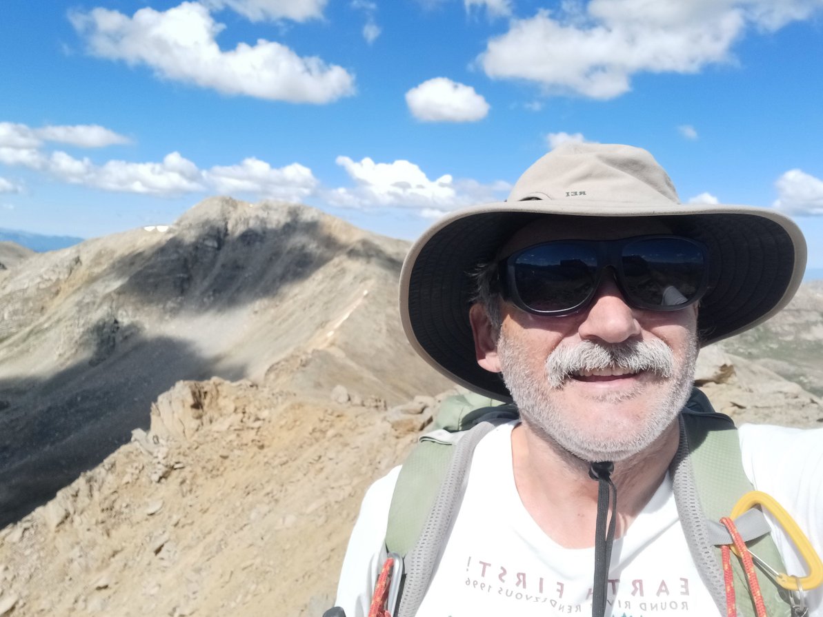
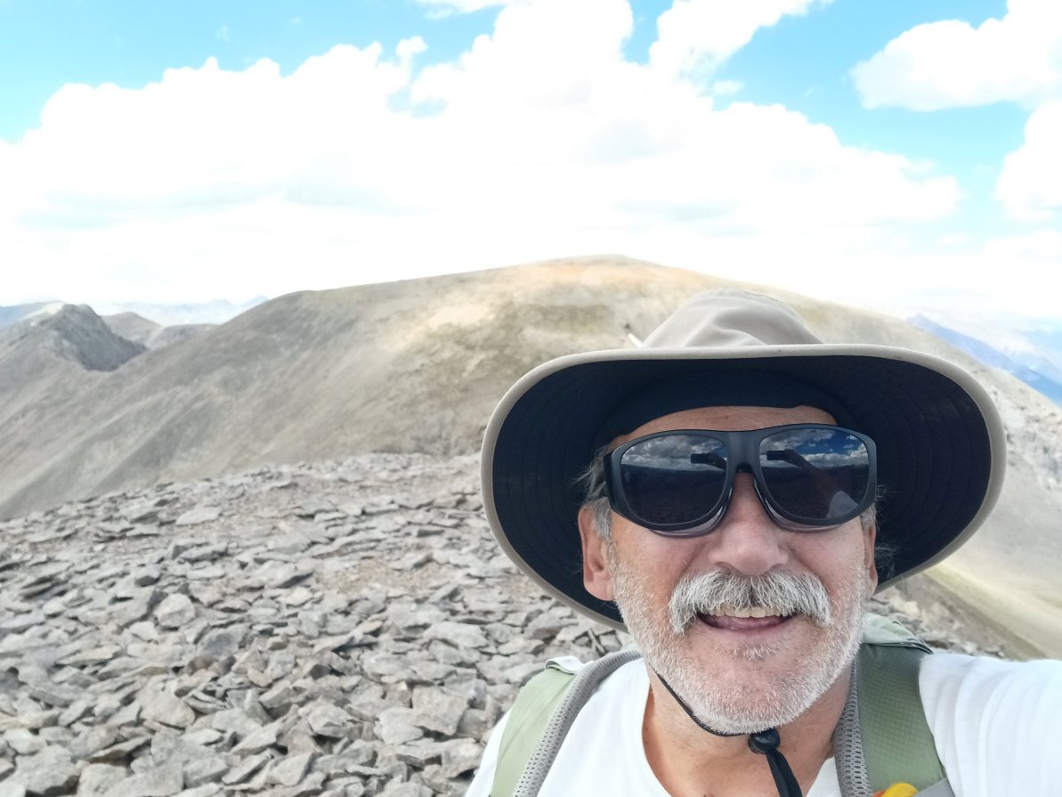
Wheeler Peak, Nevada (13,063 ft / 3,982 metres)
Wheeler Peak is Nevada's second highest - see my note, below, about Nevada's highest point, Boundary Peak...
 1. Me |
 2. Mailbox peak register |
 3. Me and the mailbox |
 4. Summit register |
 5. Trail up |
 6. Wheeler Peak |
|
|
Click Here for my YouTube video on top Wheeler Peak... |
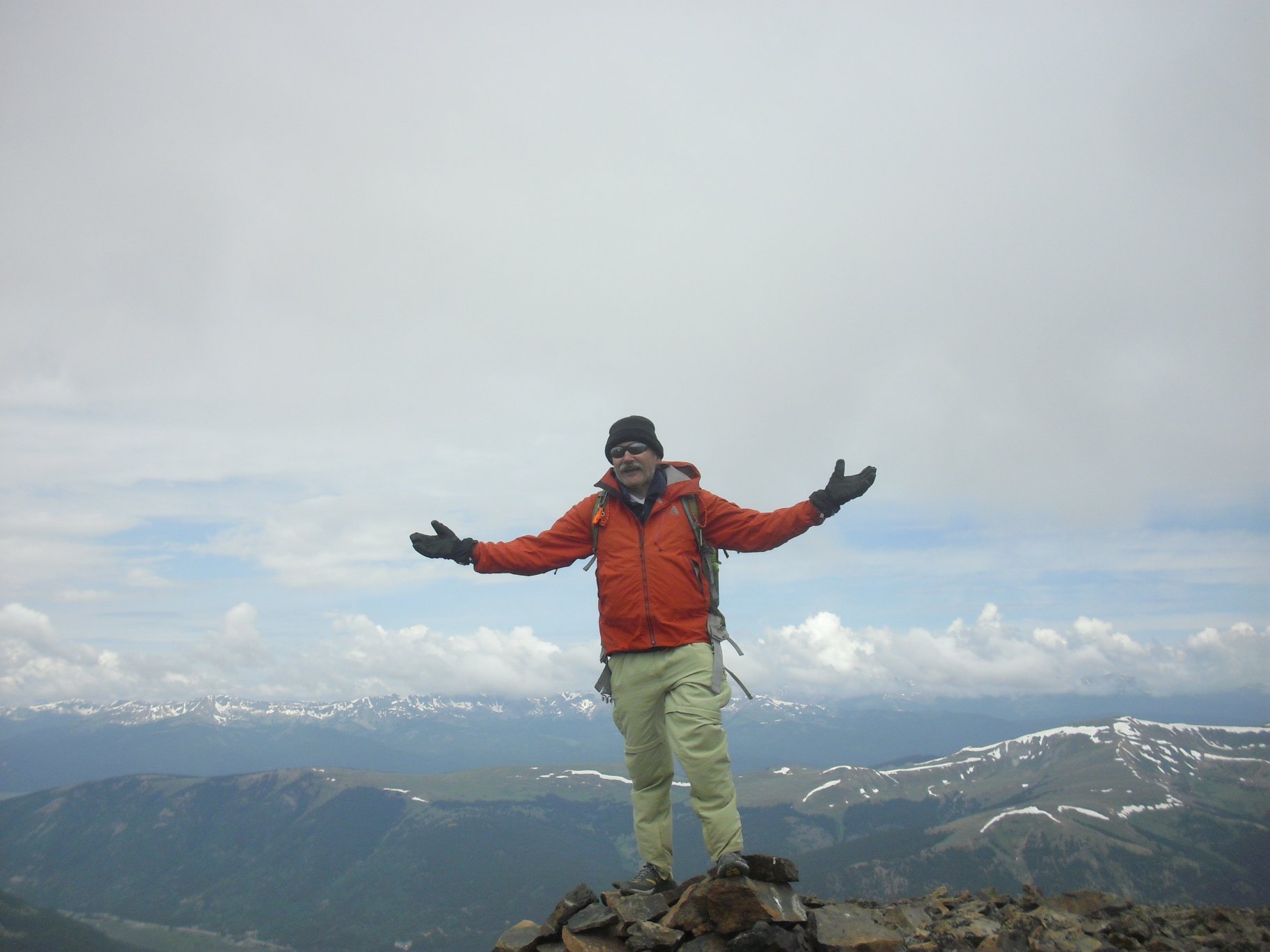
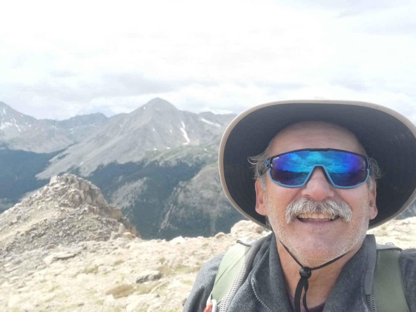
Boundary Peak, Nevada (13,063 ft / 3,982 metres) and Montgomery Peak, California (13,441 ft / 4,097 metres)
Boundary Peak, located just a couple hundred metres from the California border, is the highest point in Nevada. Boundary is pretty much a sub-peak of Montgomery Peak (which is physically located on the other side of the border in California). Since the two peaks are one kilometre apart, with only a 253 foot (77 metres) drop in the connecting saddle, Boundary doesn't receive the amount of attention that Nevada's second highest peak (Wheeler) does at 82 feet less elevation (4,007 metres) in near the state's eastern border with Utah. In either case, I've climbed all three and only reached Montgomery's summit by first stopping on Boundary. All three are nice climbs and, as you can see from the accompanying videos, I pretty much had 'em all to myself!
 1. Boundary Peak |
 2. Me on Boundary Peak |
 3. Wild horses at the trailhead |
 4. Montgomery as seen from Boundary |
 5. Me on Montgomery |
 6. Montgomery Peak register |
|
|
Click Here for my YouTube video on top Boundary Peak... |
|
|
Click Here for my YouTube video on top Montgomery Peak... |
|
|
Click Here for my YouTube video about the wild horses at the Boundary Peak trailhead... |
Whale Peak, Colorado (13,078 ft / 3,986 metres)
CMC leader Dave Riter took a handful of us up this delightful little peak on a comfortable summer's day in July:
 1. Dave, Gordon, Dave, Marty, Elise |
 2. Gibson Lake (3,615m elevation) |
 3. Whale Peak |
 4. Gordon, Dave, Elise, Dave, me |
 5. Me |
|
|
Click Here for my YouTube video on top Whale Peak... |
Jupiter Mountain, Colorado (13,830 ft / 4,215 metres)
While climbing 14ers in Chicago Basin I took time out to climb Jupiter - one of Colorado's "Centennials."
 GPS with Windom and Sunlight |
 The side of Jupiter |
 5 Year old summit register |
 Me, Windom and Sunlight |
 Jupiter's summit |
|
|
Click Here for my YouTube video on top Jupiter Mountain... |
Mt. Kelso, Colorado (13,164 ft / 4,012 metres)
Steve Farley and I climbed 13,164 foot (4,012.38 metres) Kelso Mountain on Saturday, August 2, 2003. Kelso is located in the Arapaho National Forest between Girzzly Gulch and Stevens Gulch, off I-70 west of Denver. In the first photo Steve's silhouette is standing between Grays and Torreys, two VERY popular 14ers. On that day there were well over 200 private vehicles parked at the trailhead, and along the road, yet we had all of Kelso to ourselves!
 Grays, Torreys and Steve |
 August snow field! |
 Roger loping |
 Steve is not a minor |
 Mine is over 12,000 feet |
 Mine shack |
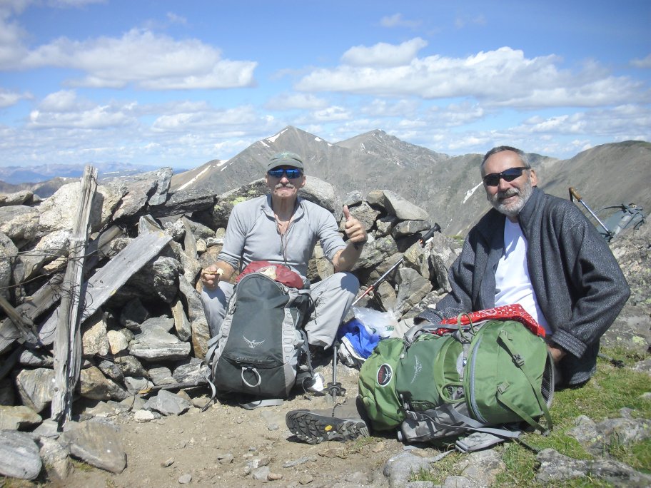
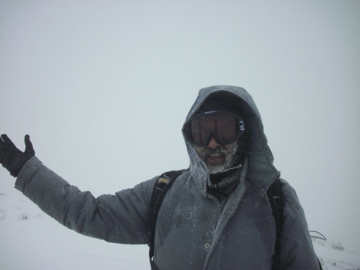
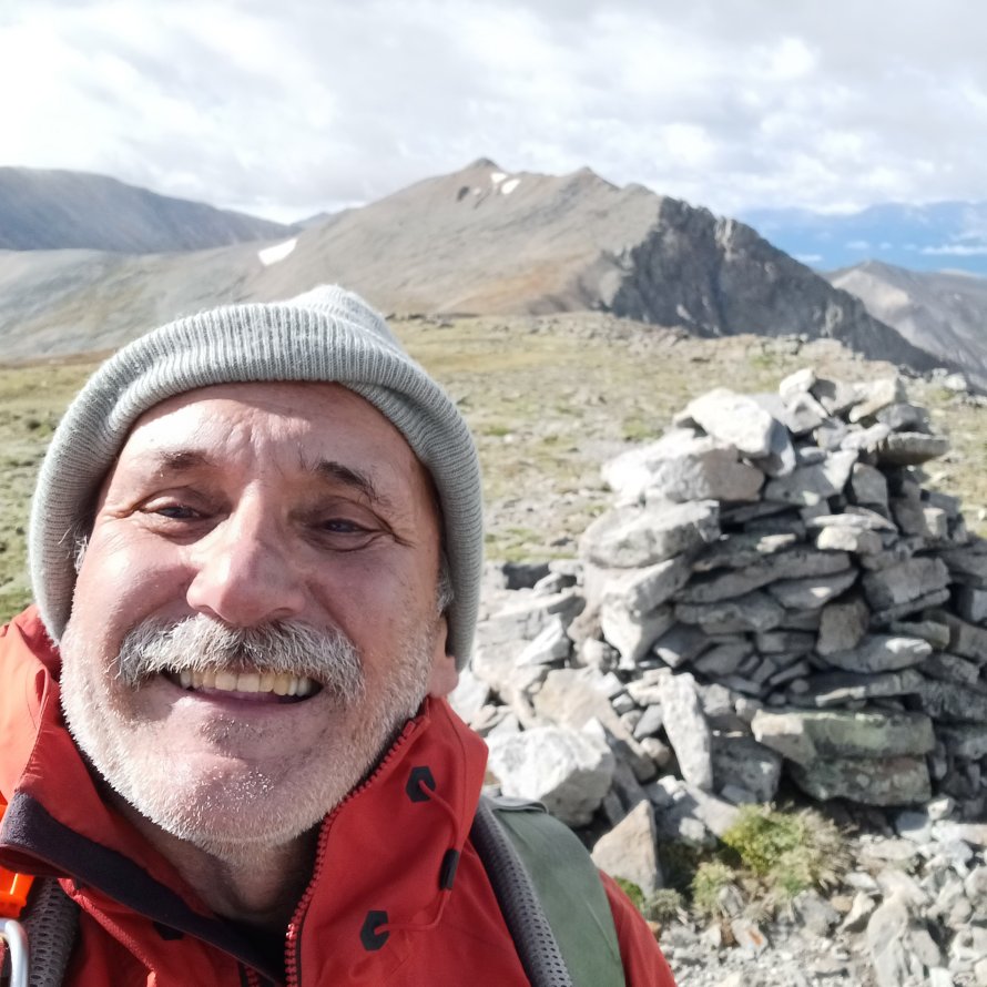
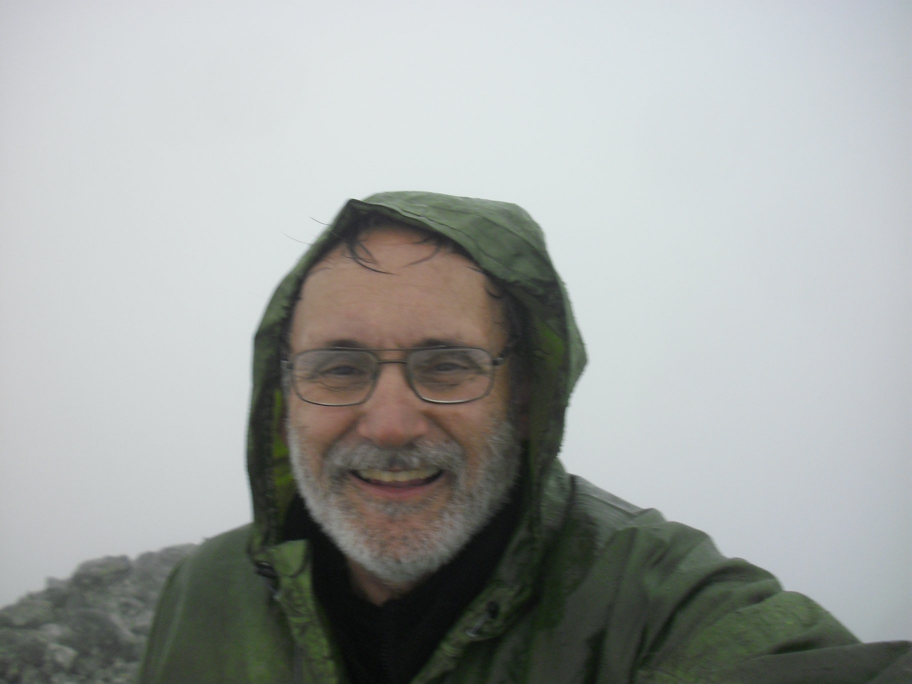
Atlantic Peak, Colorado (13,841 ft / 4,219 metres)
Dan Kinzie led our group of 11 CMCers up Atlantic Peak on a very wintery day in October!
 Heading up |
 Dan Kinzie |
 My rear-end... |
 Ice (and gray...) in my beard |
 Small avalanche crack |
 Me on top |
|
|
Click Here for my YouTube video of our winter experience on top Atlantic Peak... |
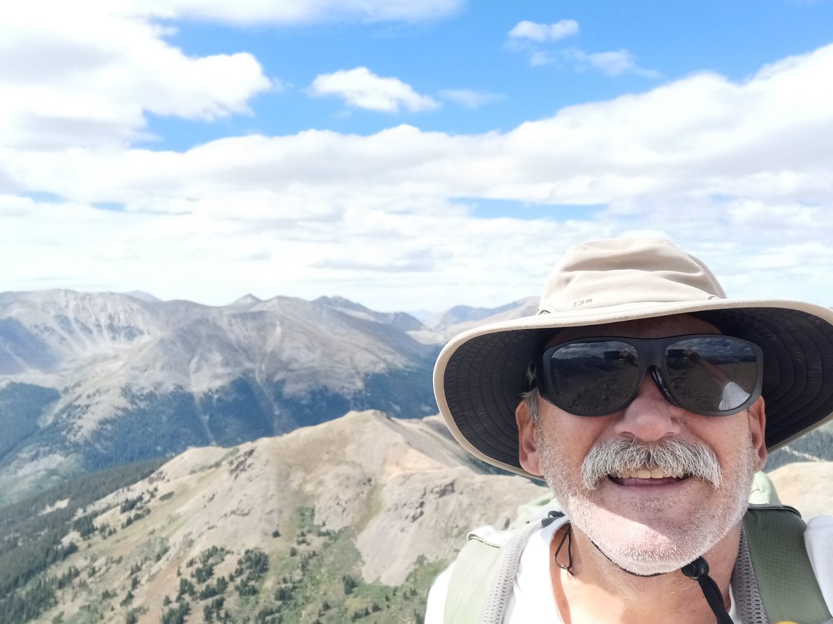
Miscellaneous 13ers:
 Point 13,660 (Lackawana) |
 Lackawana Peak (Sawatch) |
 Rosalie Peak (Front Range) |
 K2 (Elks Range, Colorado) |
 Horseshoe Mountain, Colorado |
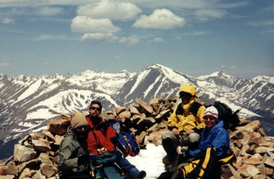
 Gemini Peak 1997 |
CMC Leader Ken Yarcho took us up to the top of Gemini Peak on July 20, 1997. That's Ken standng at the left. I'm next to him with the gray baseball cap. The others are Candice Skalet, Ed Wilkes, Dave Pitney, Steve Haymes, Bill Markley, Frank Kucler and Ray Miskines or Mark Mulligan (I'm not sure, so any help would be appreciated!). |
 - 06-10-2011") Mt. Walter, New Mexico - 13,141 ft |
Mt. Walter, in the state of New Mexico near its border with Colorado, isn't a "real" 13er since it's only a few tens of metres away from that state's highest point, Wheeler Peak (0.51 kilometres to be exact...) with just under 53 feet of topograpic prominence. Nevertheless, the people of New Mexico felt this point to be of enough importance to put a sign on it, naming it after a native son who loved the area! |
Bolivia:
(Click Here for my Bolivia page)
 Me on Cernoke summit (13,697) |
 Cernoke is near Copacabana |
 Half way up Cerro Calvario |
 Me on top Cerro Calvario (13,031) |
 Cerro Calvario summit |
A list of some of the 13ers I've summitted over the years:
Manua Kea, Hawai'iExcuses, excuses: I didn't keep good records on 13ers due to a variety of reasons but mostly because I thought them to be rather common [There are about 584 of 'em in Colorado]. Also, it's sometimes difficult to obtain a full 3,000 feet of elevation gain, on some of them, while others were "summitted" on a trail that was leading to some other landmark or an even higher summit. Others were unnamed so I paid even less attention to them while others were a bit illusive with me just getting within a few minutes of the summit before being forced off by weather. [Pettingell Peak and North Star Mountain come immediately to mind as "near misses" due to really bad weather. North Star was especially interesting with Park County out looking for us, due to a heinous snowstorm that had moved in, but ending in self rescue (04/22/2000)]
13er Waypoints

For personal safety, and just for the fun of it, I usually take a GPS "reading" on the top of each peak, at the trailhead, or some other interesting point or curiosity along the way. WARNING: I cannot guarantee the accuracy of these waypoints as my own GPS bounces around a lot or I simply take an incorrect reading! Please rely on a more accurate source for your Waypoints! That being said, I still enjoy "cataloging" Waypoints and I keep a bunch of other locations, from around the world, on my 12ers, 13ers, 14ers, Hiking, Waypoints, and other pages...
Colorado 13ers I've climbed:
(that I could remember to record here...)
|
|
Other 13ers I've been on outside Colorado:
| Boundary Peak, Nevada | N 37° 50.767' | W 118° 21.080' | 13,140 feet | 4,005 metres |
| Kings Peak, Utah | N 40° 46.580' | W 110° 22.379' | 13,528 feet | 4,123 metres |
| Mauna Kea, Hawai'i | N 19° 49.371' | W 155° 28.152' | 13,796 feet | 4,205 metres |
| Montogmery Peak, California | N 37° 50.311' | W 118° 21.421' | 13,441 feet | 4,097 metres |
| Wheeler Peak, Nevada | N 38° 59.148' | W 114° 18.834' | 13,063 feet | 3,982 metres |
| Wheeler Peak, New Mexico | N 36° 33.413' | W 105° 25.015' | 13,161 feet | 4,011 metres |
Some Trailheads:

Mount Evans Wilderness, Colorado
Berthoud Pass trailhead - US Highway 40
Berthoud Pass summitN 39° 47.902' W 105° 46.563' 11,307 feet 3,446 metres Boundary Peak Wilderness trailhead, Nevada N 37° 52.150' W 118° 18.371' 8,728 feet 2,660 metres Chicago Lakes Number 52 trailhead, Colorado (up past the Idaho Springs reservoir and cabins) N 39° 38.391' W 105° 37.007' 10,660 feet 3,249 metres Deer Creek trailhead (for Rosalie Peak), Colorado N 39° 30.633' W 105° 34.070' 9,323 feet 2,841 metres Henry's Fork trailhead (for Kings Peak), Utah N 40° 54.548' W 110° 19.872' 9,430 feet 2,874 metres Pole Creek/Elkhart Park Trailhead for Gannett Peak, Wyoming N 43° 00.245' W 109° 45.107' 9,225 feet 2,812 metres Wheeler Peak trailhead, New Mexico (Taos Ski area) N 36° 35.824' W 105° 26.944' 9,352 feet 2,850 metres
Prominence, a Definition:
In topography, "prominence" is the height of a mountain or hill's summit by the vertical distance between it and the lowest contour line encircling it and no higher summit - Prominence is a measure of the independence of a summit. Only summits with a sufficient degree of prominence are regarded as independent mountains. For example, the world's second-highest mountain is K2 (height 8,611 metres, prominence 4,017 metres). While Mount Everest's South Summit (height 8,749 metres, prominence about 10 metres) is taller than K2, it is not considered an independent mountain because it is a subsummit of the main summit (which has a height and prominence of 8,848 metres).
|
|
Click Here for red, pink, and "Watermelon Snow" at the bottom of my Snow Day page... |
Yosemite Decimal System
The Yosemite Decimal System (YDS) is a three-part system used for rating the difficulty of hikes and climbs. YDS is primarily used by mountaineers in the United States and Canada. However, there are many different rating systems used around the world. Examples include the British trad grade, the French sport grade, and the International Climbing and Mountaineering Federation's (UIAA) alpine grade. As for the YDS, it was first devised by members of the Sierra Club in Southern California in the 1950s. YDS was a refinement of earlier systems, particularly those developed in Yosemite Valley.Class 1: Hiking on a trail.
Classification of climbs can vary quite a bit depending on location and history. Indoor gym ratings tend to be inflated compared to outdoor ratings. Ratings tend to be lower in outdoor areas where climbing routes were developed in earlier years. Guidebooks have often raised the ratings on older climbs to make them more comparable to newer ratings. The YDS grade system also involves an optional Roman numeral grade that indicates the length and seriousness of the route. The grades are:
| Grade | Duration |
|---|---|
| I | One to two hours of climbing |
| II | Less than half a day |
| III | Half a day climb |
| IV | Full day climb |
| V | A climb lasting 2–3 days |
| VI | A climb lasting 4–6 days |
| VII | A climb lasting a week or longer |
Links:
| Warning! Climbing, mountaineering, and backcountry skiing are dangerous and can seriously injure or kill you. By further exploring this website you acknowledge that the information presented here may be out of date or incorrect, and you agree not to hold the author responsible for any damages, injuries, or death arising from any use of this resource. Please thoroughly investigate any mountain before attempting to climb it, and do not substitute this website for experience, training, and recognizing your limitations! |
 Back to Roger J. Wendell's Home Page...
Abbey |
About |
Blog |
Contacting
Me |
Copyright |
Disclaimer |
Donate |
Guest
Book |
Home |
Links |
Site
Index |
Solutions |
Terms,
Conditions
and
Fair
Use |
What's
Changed
or
New?
Copyright
© 1955 -
 - 06-10-2011")


