Roger J. Wendell
Defending 3.8 Billion Years of Organic EvolutionSM

Me climbing Mt. Rainier (14,412 feet/4,392.7 metres ) in shorts - July 2000"Fourteeners" are mountain peaks between 14,000 and 15,000 feet (4,267.2 and 4,572.0 metres)
Colorado is home to 58 recognized 14ers. Technically, there are 53 14ers in the state that meet the requirement of a 300 feet of drop in a connecting saddle. Out of tradition, an additional five 14ers are usually added to the total list of 14ers in Colorado.
Yes, in addition to having climbed all of Colorado's 14ers (at night, in snowstorms, and in all kinds of other weather!) I have also summited Mt. Whitney (California) and Mt. Rainier (Washington State), and am always on the lookout for other interesting peaks and highpoints around the world!
| NOTE: LIDAR (Light Detection and Ranging) was put into use many decades after I started hiking and climbing. LIDAR is a more accurate way of measuring the Earth's surface and, as such, has changed what was believed to be the elevation of many mountains and highpoints. As a result, the "prominence" (at least 300 feet above a connecting saddle) of many mountains has changed along with their elevations. A personal example, for me, is Republican Mountain - a previously "unranked" 12er near Silver Plume that I climbed in 2022 after learning that LIDAR had determined it now had 312 feet of prominence. Peak 8, near Breckenridge is another personal example of change brought on by LIDAR. When I originally climbed Peak 8 I believed it to be a 12er, only to learn later that it's actual elevation is 13,005 feet! So, in summary, many of the elevations you see on my pages may not (yet) be accurate - requiring an update someday in the future as time permits. However, in erly 2024 I was able to update National Geodetic Survey (NGS) data for the 14ers on this page... |
|
|
Click Here for my 13ers page... |
|
|
Click Here for my 12ers page... |

|
Click Here for the Ten Essentials - Don't leave home without 'em! |
|
|
Click Here for my page on highpoints... |
|
|
Click Here for my general notes Climbing and Mountaineering. |
|
|
Click Here for other peaks and mountaintops that I've summited... |
Click on any of this page's "thumbnail" images for a larger view!
Some "Rules" and History:
Mary Cronin looking up Kilpacker Creek on the way up Wilson Peak. August 2, 1923.
Photo by Agnes Vaille. Courtesy of the Colorado Mountain Club.Carl Blaurock (1894 - 1993), one of the Colorado Mountain Club's charter members,
was the first to summit all of Colorado's 14ers with his climbing partner, Bill Ervin, in 1923.
Mary Cronin (photo at left) became the first woman to "bag" all of Colorado's 14ers in 1934.
"While the exact history behind Capitol Peak's name isn’t exactly known, experts believe it could have stemmed from the shape of the mountain. It was named during the Hayden Geological Survey in 1874, though the group claimed the peak was inaccessible and they weren't able to summit it during that expedition.
"According to an issue of Trail and Timberline by the Colorado Mountain Club, a member of that survey named W.H. Rideing wrote about Capitol Peak and the nearby Snowmass Mountain: 'After mature deliberation the expedition rechristened them the Whitehouse and the Capitol, under which names we suppose they will be familiar to future generations.' Capitol retained its name and Whitehouse was later renamed Snowmass Mountain."
- Stephanie Butzer, from TheDenverChannel.com, July 14, 2020,
Stories behind the summits: The history, origin behind the name of every Colorado 14er
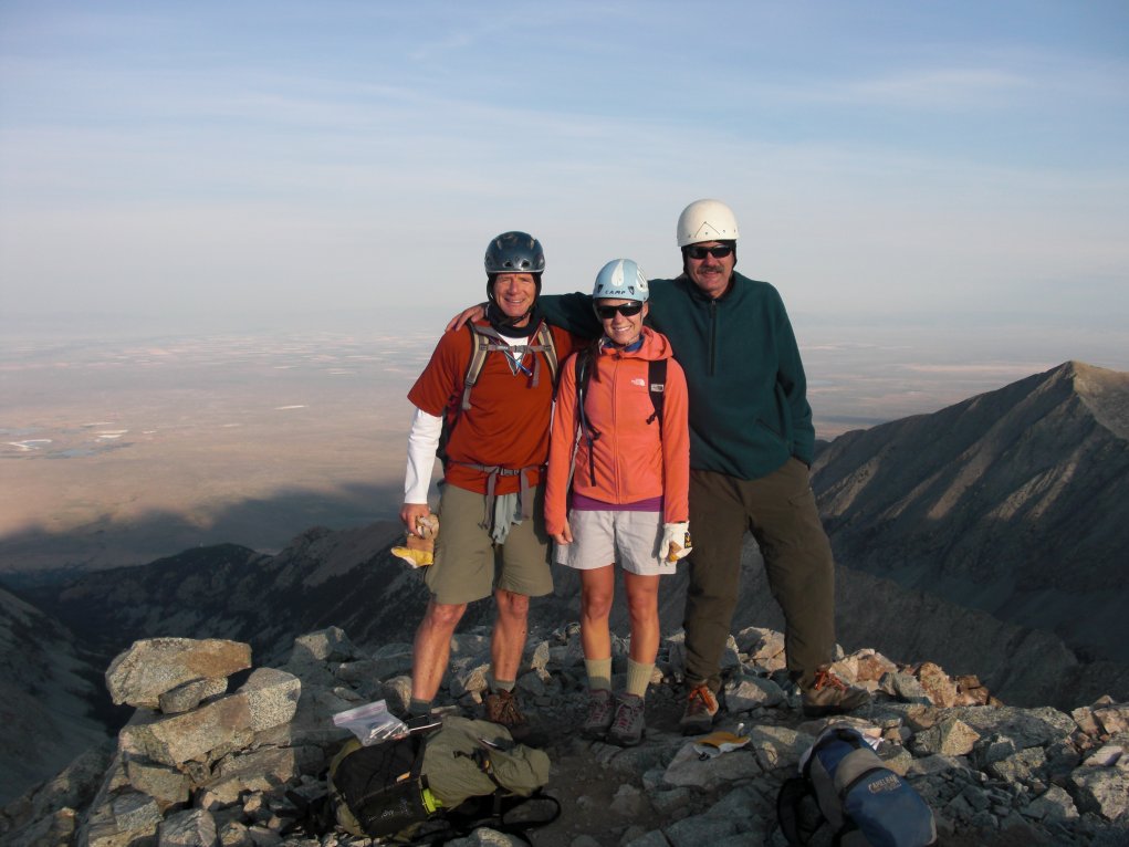
Me, Amber & Ham Radio
on top Mt. Evans (1993)
Mt. Princeton - 4,327 metresThe most popular climbs, in Colorado, are the "14ers" - 14ers are usually defined as any mountain with a summit that's over 14,000 feet (4267.2 metres) with a rise of at least 300 feet (91.44 metres) above a connecting saddle with topographic prominence and isolation. Over the years there has been some disagreement over the actual number of 14ers in Colorado - the figure usually hovers between a total of 52 and 54, with 53 being the current agreed upon number. However, it's also recognized that Colorado has an additional five "unofficial" 14ers which brings our state total to about 58. Nationwide, in the lower 48 states, there are a total of 70 14ers (not counting the unofficial ones) - One in Washington State and the remaining 15 in California. Gerry Roach, and many others (including me!), believe that you must ascend at least 3,000 feet (914.4 metres) under your own power to have properly climbed a 14er. This means that if you park your car at the lot on top Mt. Blue Sky (formerly Mt. Evans), the remaining walk of 100 feet (30.48 metres), to its 14,268 foot (4,348.8 metres) summit, doesn't count! However, if you parked your car a dozen miles down the Mt. Evans road, and gained the final 3,000 feet on foot, while on the paved surface, your climb would be considered a success!
Okay, maybe I've taken this a bit too far as helpful folks have seen me walking with a full pack a mile or two below the trailhead where everyone else is parked - they often have asked, "Need a ride to the trail?" What I'm usually up to is carefully monitoring my GPS ANYTIME I think we're parked closer than 3,000 feet from the summit!
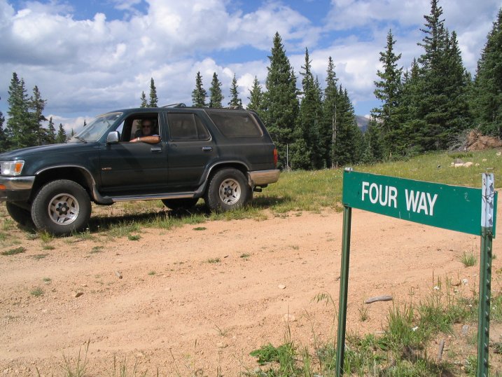
For example, on Culebra, the ranch officials said that parking at Four Way was as close as they could guarantee to 3,000 feet (plus, Four Way and the trailhead itself, up a mile further, are the ranch's only authorized parking). I think my GPS was a little flaky that day as I hiked back down one of the Four Way roads, about a third mile, to pick up almost 400 feet of extra gain before returning to the car/hike. I've taken similar actions on Bierstadt, Sherman, the Lincoln/Democrat/Bross/Cameron combo, and other peaks as well. Nevertheless, it's up to you, gentle reader/hiker, to decide what lengths you need to go to ensure 3,000 feet of elevation gain to claim that next 14er!
Gerry Roach and MeAnyway, in his book Colorado 14ers Gerry Roach goes on to explain that; "Climbers should carry their equipment, not let their equipment carry them." In that paragraph he's referring to bicycle rides to the summit and even somebody using a treadmill, all winter long, to charge their battery bank for an electric car ride to the top of Evans. Either way, after these few paragraphs of haranguing, I think you get the idea when it comes to 14er "ethics!" Finally, you'll find that there's not much privacy on the more popular 14ers during the summer - the crowds are plentiful and the parking sparse. Late fall and winter offer the most solitude but, of course, have a lot more added weather danger. Anyway, even during the summer months you'll find that "Peak Baggers," in general, are a friendly bunch that are always willing to help out or just provide a cheerful "Hello!" along that slow slog to the top! Anyway, climbing 14ers offers all kind of nice experiences and rewards (physical fitness, getting closer to Nature, etc.) so get out there enjoy! And, of course, be safe!
Some Fourteener Fast Facts!
What You Need to Know to Climb Your First 14er!
Denver Post, Summer Getaways, May 19, 2019 - pp. 18-20 (they quoted me!)


Click Here for the Denver Post article on What You Need to Know to Climb Your First 14er!
Click Here for a rough copy of that same article in case they kill the link without telling me!
[The article starts quoting me on the second page and then further down. Here's a sample; "'It’s a tremendous amount of elevation gain,'said Roger J. Wendell, a certified CMC leader who has three decades of volunteer experience with the 107-year-old club. 'That’s a huge day for anybody. The trail is long, there is exposure and people somewhat regularly die on Longs. You can die on any of them, of course, but Longs has that added risk. Plus, with so much elevation gain, if you’re coming from the flatlands, the altitude can really take its toll on you. We’d like to keep you at about 3,000 feet of gain if you’re a beginner.'"]
How Many People Have Climbed All Of Colorado's 14ers?
In August, 2015 Steve Mulhern wrote me to ask this question - as many had done before. The

following, posted with his permission, is our exchange with my answer for him and others:
Steve,Thank you for writing! My apologies for the late response but I've been traveling, a lot, and am just now getting caught up on email and other business.
Anyway, as you may have guessed, it's going to be difficult to answer your question as there's no accurate way of tracking the number of Colorado 14er finishers. Nevertheless, I think I can come up with a rough estimate that would seem reasonable. My guess is is that there have been fewer than 5,000 people who have summited all of Colorado's 14ers as of this writing.
I base my guess on a couple of sources: The first is the Colorado Mountain Club's (CMC) "Fourteener Files" list that comes out once each year in their Trail and Timberline publication. As of last winter's listing, there were 1,627 people who had taken the time to report their completion record to the publisher since the 102 year-old-club started keeping records.
My guess is that that number represents about a third of those who have actually completed the 14ers (based on my interaction with hundreds of people on the trails over the past 45 years that I've been in Colorado). In other words, for every person who takes the time to contact the CMC about their completion there's probably another two who do not. Also, it may be interesting to note that the CMC's list isn't restricted to club members and, as I know from my own experience in working and volunteering for the club, the publisher receives quite a few submissions from non-members each season.
Secondly, I believe it was about five years ago that longtime Colorado Mountain Club member Gerry Roach (author of the very popular "Colorado's Fourteeners" book), estimated the total number of finishers to be around 3,000 - a number that was well over twice that recorded in the CMC's "Fourteener Files" at the time.
Finally, extrapolating from Gerry's estimate, my own interaction with hundreds of hikers over the years, the current number of finishers in the CMC's "Fourteenr Files," and then throwing-in another hundred or so for good measure - I come up with a figure that's still well under 5,000 completers as of summer 2015.
I hope this helps! I'm also curious to know if you and your son were able to finish your three remaining 14ers since you first wrote me a few weeks ago? If so, my hardiest congratulations! If not, I look forward to running into you guys on the trail as you finish-up!
Looking forward!
- - - - - - - - - - - - - - - - - - - - - - - - - - - - -
August 2, 2015
Greetings Mr. Wendell...
I'm sure you have better things to do than respond to me (you seem to have more interests than I have thoughts)... but I thought to ask if (on the off chance) you might have the answer to this question:
What is the approximate number of people who have summited all of the Colorado 14ers?
My son and I are close to finishing all of the primary 14ers--- the 55 in Roach's book--- together. As of today, we have three left. In the end we'll actually have 57 of the 58 since we missed Conundrum due to a thunder head. We started this journey when he was 8. He is now 24. As we're closing in on the end of this adventure, we get an array of questions that I have to research before I can answer them. Last night at a party someone asked me the question above. Again, I have "no idea" how to respond to this... is it 500,000... 250,000... 100,000... 10,000? It seems to me it would be close to 100,000... true?
I would love your thoughts. Your name and website popped up as I was "googling" this question. Neither 14ers'.com or Summit Post seemed to have a good answer or blog addressing the question.
As (or if) time permits...
With a thanks to you for reading this.
Peace,
Steven C. Mulhern
Three Generations of Family Summit Pikes Peak Togehter!
Roger,

On August 2, 2023, I and 6 family members (3 generations) climbed Pikes Peak via Barr Trail... wonderful experience. Maybe of interest is the fact that the age differential between myself and my younger of 2 granddaughters that climbed is 64 years... I am 76 and she is 12. Is there some type of official journal/document/whatever that is kept and may maintain this type of anecdotal information? If, "yes", I can provide whatever information needed to validate our ages, date of climb, photographs and etc. Would appreciate knowing and following up if needed.
Sincerely,
Jim Cartwright
- - - - - - - - - - -
Hi Jim!
Although I, myself, am not an expert I did some research on 14ers a few years back and don't recall running into this kind of information, either. However, I wouldn't mind including it, with a photograph, on my own 14ers page if that would be of interest to you?
Roger
Your site said "responses are quick" but wow, that was quick quick…and thank you. I've attached two photos below with this response (I assumed you wanted me to respond here). One is of the group of 7 including the 3 generations…2 sons (Fletcher and Nate)…1 son-in-law (Alex)…1 daughter-m-law (Leanna) and the two granddaughters (Kennedi 12 and Adelie 13 who made the climb)…and me. Of note the flag was created to represent the states housing our various families (Ohio, Minnesota and Arkansas) and names of in-law families with our Cartwright family plus the red rocker (this represents 6 generations on my mother side which has all of the names of the children that were raised over the 100+ years who sat in the real red rocker). The second photo is of Adelie, me and Kennedi. Appreciate you including what is of value, fun and convenient for you on your blog…honored...especially seeing what an accomplished climber you are and the support and respect you have for these magnificent wonders of nature. If you'd like any additional information, please ask. Thanks again…
Best,
Jim
DeCaLiBron (Democrat, Cameron, Lincoln, and Bross) and Private Property Issues...
Yes, there are many mountains around Colorado, our country, and the world that are either privately owned or controlled by some form of government. As discouraging as closures can be at times, I highly recommend you always observe the wishes of any of these property owners. As of this writing (July 1, 2021) DeCaLiBron remains closed but the Colorado Mountain Club and other entities continue working with the owners. In the past, the DeCaLiBron property owners have closed or restricted access to these popular peaks but usually opening them up again so I suggest everyone remain patient! Additionally, Culebra and other peaks have been tightly controlled by their owners, too, so I ask that we abide by their wishes and instructions as well - owners, in the past, have been known to enlist the services of local sheriff departments and legal systems for trespass violations. Property owners always have a lot of safety, liability, privacy, and resource control issues they're concerned with - much more than I could describe or detail here, so please be understanding!
My 14er completer certificate from the Colorado Mountain Club
Dangers:
Be prepared! Mountaineering, climbing, and mountain hiking, regardless the elevation, can be difficult and hazardous. Did you know that at least one person has been killed, in Colorado, from a mid-summer avalanche! In addition to avalanche hazards people have been wounded by their own ice-axes and crampons, fallen hundreds of feet, been hit by lightning, hit by falling rocks, and died of exposure (just to name a few ways you can get hurt in the mountains!). Also, a good rule-of-thumb, for any peak, is that you should be heading back down before noon. And, of course, don't hesitate to turn around if a storm is moving in, if there's lightning, or when you're feeling just plain miserable from the altitude or exertion (it happens to all of us - turn around, that peak will be there next weekend...). Be safe out there!
- Roger J. Wendell
 Bob Dorris & me on Longs Peak '96 |
According to the July 31, 2005 Denver Post (Sunday, front page story by Steve Lipsher) Longs Peak is Colorado's second deadliest 14er (right after Maroon Bells) with 55 documented fatalities since Carrie Welton died of exposure near the Keyhole in 1884. Longs Peak was named after Army Major Stephen Long who made the first recorded American sighting of the peak in the 1820s. Colorado River explorer John Wesley Powell, in 1868, was the first to climb the peak. Over 25,000 people attempt the 15 mile round-trip climb each summer with about 10,000 reaching the summit. Average time for the round-trip ascent is about 12 hours with Chris Reveley having completed it in two hours and four minutes in 1979! |
 Meeker & Longs by Chris Long |
It was never my intent to fill a page full of 14er photos because other pages, climbing books,
and trip reports did such a better job! Nevertheless, some of my 14er climbs were so much fun,
or were so interesting, I couldn't resist posting 'em here!
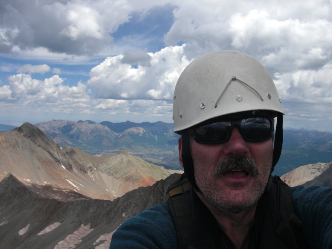
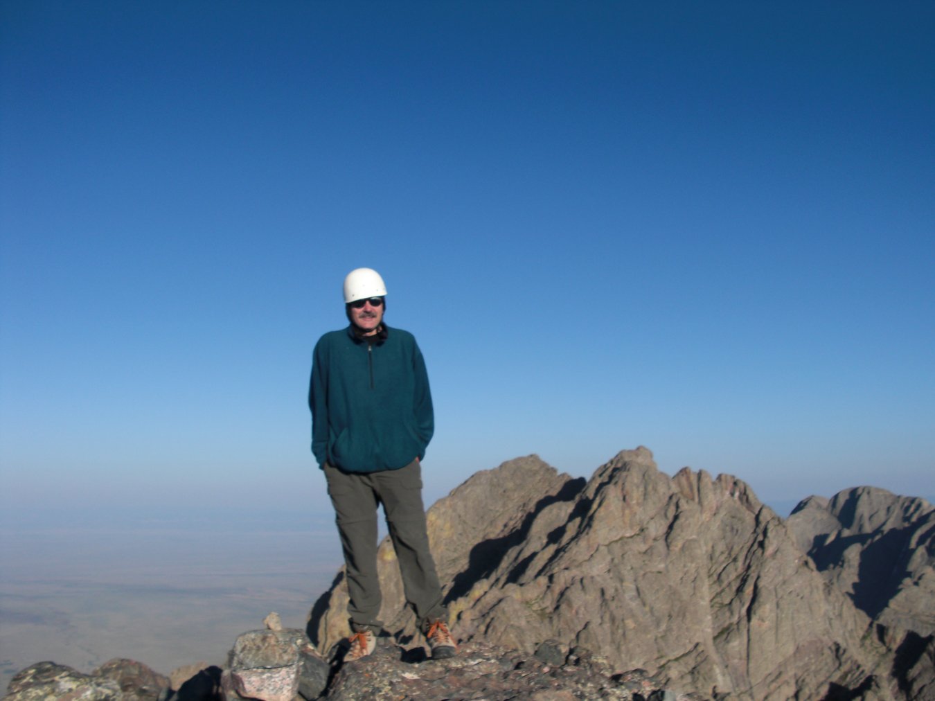
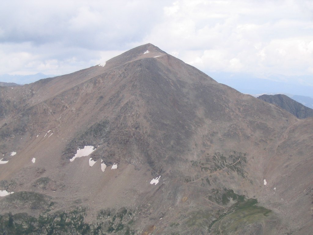
Maroon Bells (14,156/14,014 feet - 4,315/4,271 metres)
Saturday, August 23, 2008
Early morning "Bells"Steve Cummings and I left Denver's 4th and Union Park 'N Ride (the old "Cold Spring" lot) at 02:45 am after each having had less than four hours sleep! After a couple of stops and some very dark road construction we arrived at the Maroon Lake trailhead just outside of Aspen, Colorado. The trailhead sits at 9,600 feet (2,926 metres) with a completely paved access road. This is because the area gets so much use it's now required that day-visitors take a bus there. For those on an early morning climb or wanting to camp (by permit, I believe) you can park if there's any space left. At our 6 am arrival we were able to squeeze into the last remaining space for the day...
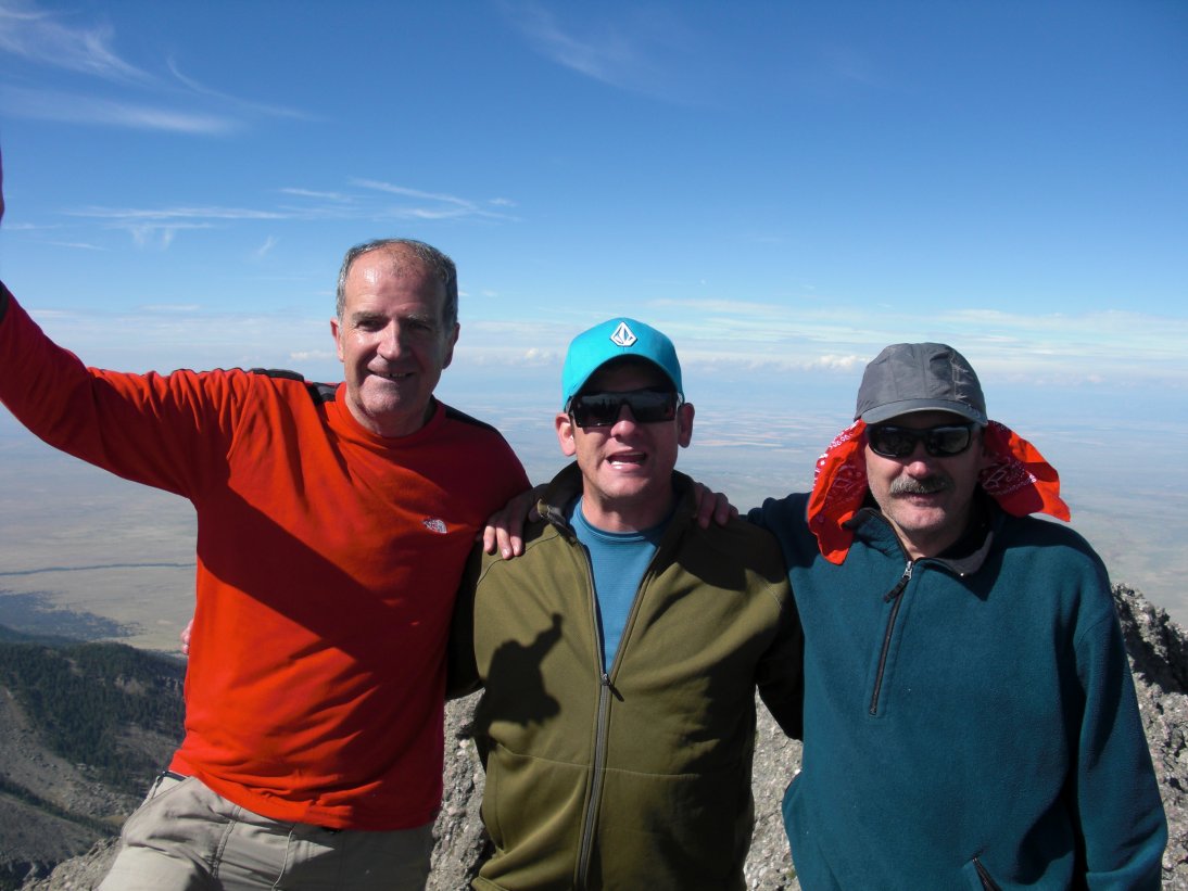
Despite a weather report for a 20 percent chance of showers the weather was beautiful and we made it to the summit of Maroon Peak in about four and half hours. The "Bells" were beautiful, we felt great, so decided to make a "loop" of it and take the traverse over to North Maroon Peak. Because there isn't 300 feet of drop on the saddle between the two peaks (interesting to note that my GPS said the two summits were exactly 0.37 miles/0.6 kilometers apart - not much!!) North Maroon is not considered and "official" 14er. Nevertheless, it's a fantastic climb (and I do mean climb!) so I highly recommend it if you have the skill and are properly prepared with helmets (which I had forgotten mine, as usual...) and other essential gear, food and water.Although there were maybe only a total of 15 people on both peaks for the day there was a bit of a bottleneck along the traverse due to the difficulty in route finding and having to scale 4th and 5th class terrain. However, the bottle neck was fortuitous in that we got to meet some really great people that we hope to encounter again on future trips! Zachary and his dad Pat, "El," Ben, and a half dozen others I met (but don't recall their names) we're fun climbing companions for the rest of the day.
Anyway, it took us about an hour and a half of some pretty serious climbing to get us across the aforementioned 4th and 5th class terrain of the traverse between "south" and North Maroon. As somebody reminded me, to be successful on such terrain you have to be good at either route finding or 5th class - and that's the truth! Nevertheless, everybody made it safely across and if you count our summit time on "South" Maroon it took a total of about six hours to reach North Maroon.
The weather remained perfect until it was time to descend. Some clouds moved in with what appeared to be rainfall off toward the horizon. Luckily it never reached us as it stayed mostly clear all the way back down. However, going down off North Maroon, especially after having not seen it before because of our decision to do the loop, was no easy task as route finding became even more difficult. Ben and I followed some cairns for what we thought was the shortest route but then had to climb back up a few hundred feet to get back on course again. Apparently some cairns are in place to guide snowboarders and backcountry skiers to the steepest winter terrain - something a couple of peak baggers weren't prepared to negotiate this early in the season.
In conclusion, the "Bells" were the most fun I've had, thus far, in my experience on 36 of Colorado's official and unofficial 14ers. And, although the "experts" can probably complete both peaks in a half dozen hours it took us well over ten with a considerable amount of fatigue. And, even though people might consider the "Bells" to be routine I'd still encourage you to bring along a helmet, adequate maps/written guides, and the proper amount of food, water, and outdoor gear!
- Roger J. Wendell
August 24, 2008 (Sunday, the day after!)
 El climbing the traverse |
 Looking towards North Maroon |
 Me, Pat, Zach, El, and Steve |
 Pointing to the peak! |
 Roger on Maroon Peak |
 Steve heading up Maroon |
 Steve going up Maroon |
 Me & Steve on Maroon Peak |
 Roger on North Maroon |
 Steve on the traverse |
|
|
Click Here for my YouTube video of our politics on North Maroon Peak! |
|
|
Click Here for my YouTube video of Steve and El climbing the traverse between "South" and North Maroon... |
|
|
Click Here for my YouTube video from the summit of Maroon Peak... |
Mount Shavano (14,229 ft/ 4,337 m)
Saturday, October 29, 2005
Greg Olson
Lisa Herter
Summit Register
Road to Shavano
Heavy Winds
Named after Chief Shavano, a leader of the Ute Mountain Tribe, Mount Shavano Peak is located in the Sawatch Range of central Colorado. Roger Edrinn, in his Colorado Fourteeners "Pocket Slam," rates it as moderate in difficulty. Greg Olson and Lisa Herter took me along for their Saturday workout (4,500 feet of elevation gain!!) in preparation for our Ecuador adventure just two months away. I thoroughly enjoyed Shavano despite the below-freezing temperatures and screaming wind gusts between 40 and 50 mph - the trail was relatively easy to follow and the views, during cloud clearings, were spectacular! There was some sporadic "post-holing" required, above 13,000 feet, plus I had to dig around in the snow a bit to find the summit register. All in all it was a grand fall day!
Kurt conquers Mount Bierstadt on one leg!
I had the honor of climbing to the top of Mount Bierdstadt with Kurt and friends in August of 2014. Kurt lost all of his leg, and much of that hip, to cancer just the year prior. Kurt's recovery has been more than miraculous with him completing the entire climb unaided. A vidographer accompanied the climb so I hope to link the video if it becomes available. Congratulations Kurt!!

|

|

|

|

|

|

|

|

|

|
Mount Yale (14,196 ft / 4,327 m)
Saturday, October 15, 2005 - a mini epoch!
Tom and Linda Jagger, having already completed over 43 and 51 14ers, respectively, graciously agreed to lead me up Mt. Yale after a pretty good snowstorm earlier in the week. I think the snow depth (averaging between 12 and 18 inches) caught us all by surprise as it took us about five hours to climb 4,300 feet to the summit! The slick surface, with unpredictably loose rock beneath, took its toll on us as we post-holed our way across some pretty steep terrain. I didn't get any pictures of the hard parts because I was just too tired to take the camera out of my pack!!
Linda and Tom making their way up...
Tom and Linda on Yale's summit
A very thankful Roger on Yale's summit...
Grays (14,270 ft / 4,349 m) and Torreys (14,267 ft / 4,349 m)
Sunday, August 14, 2005
On this date I thought I'd just "run" up Torreys for some quick exercise since it had been raining for the past couple of days throughout most of the state. It turned out to be much more fun than I had imagined since there was a Ham Radio 14er event taking place all over Colorado that day (see more related photos at: my antenna page). Also, I ran into this wonderful couple (I hope they remember my email address so that I can properly label their photo someday!) practicing with their bicycles for the Montezuma's Revenge event. And, of course, I encountered the usual array of friendly, outgoing "peak baggers" who are always willing to help with directions or whatever on Colorado's 14ers!
 Bikes at 14,270 feet! |
 Grays Peak from Torreys |
 Torreys Peak from Grays |
 Torreys Viewed from trail |
 Torreys from saddle |
 Ham Radio on Torreys!
|
La Plata Peak (14,336 ft / 4,370 m)
Sunday, September 4, 2005
Steve Bonowski took ten of us to the top:
(Sorry, couldn't catch everyone on film since it's like herding cats!)
Steve and the gang...
Siegfried on Summit Block
Mark, Me and the Summit...
Rainbow Coming Home
Babies on the Mountain!

On August 26, 2007 John Aldag and I were just descending 14,067 foot Missouri Mountain when we encountered the Williams family hiking to the top with their 13 month old baby, Katelyn. They were at 13,800 feet, moving steadily, but I just couldn't resist asking to take their photo! They graciously agreed and gave me permission to post it here as well. What a lovely family - reminding me of the time Tami and I took our newborn son to the top of Mt. Evans for a bit of scenery and fresh air during late summer 1980. Much to our own surprise (and shock) our infant son fell asleep near the summit! This worried us so we rushed back down to Denver and met with the family doctor - we were worried the thin 14er air may have been harmful and asked to good doctor why our baby had fallen sound asleep up there. The doctor calmly replied, "because he was tired..." Oh to be a young parent in our early 20s again!!
Children on the Mountain!
Little 6-year-old Aree Tukta-Botkin is the youngest person I've heard of, personally, to have climbed a 14er completely under her own power. However, I've been assured by the climbing community that other small children have done it as well. Although Aree may not have been the youngest its obvious her father, friends, and family are all proud of her achievement as evidenced by these photos they sent me - I'm honored to post 'em here as a testement to kid power!
Mt. Sherman:
Aree's father, David, added; "Thank you for your interest in my Six year old daughter Aree's summit of Mt. Sherman, August 22, 2009. She is a first grader at Edith Teter Elementary in Fairlpay Colorado. She will be 7 years old on October 1st. She summitted Mt. Silverheels a few weeks ago but Mt Sherman was her first 14er. She has been skiing for 3 years and plans to take up snow board next season. Thank you for posting the question "Youngest on 14er?" I wonder if the 3 year old's on 14ers [others have reported kids as little as 3 years old climbing 14ers - ed] climbed the whole way on their own power as Aree did? At any rate, she is proud of herself and expects to summit other 14ers on her own. I will attach some photos of her on Mt. Sherman summit and you have my permission to publish them you you like. Aree's father, David."
Mt. Sherman (14,036 ft / 4,278) and Mt. Bierstadt (14,060 ft / 4,285 m)
July 20, 1997 and July 3, 2004

This summit photo was taken on July 20, 1997. It was a CMC (Colorado Mountain Club) hike that I now have little record of so I can't identify many of the people in the photo. In the lower right is my friend Ken Yarcho (on bended knee). I'm the one in the back, standing with my legs apart. The photo was taken by Ed Wilkes. 
My brother Brian and I took a little hike up Mt. Bierstadt and enjoyed the summit with a dozen or so of our closest friends!! In this shot Brian is preparing to record his name in the summit register. These little weather-proof containers are maintained by the Colorado Mountain Club (CMC) and are very much appreciated by everyone!
A closer Look at Summit Registers:
Larry on Mt. Bierstadt
Bierstadt's summit registerIn September, 2002, my friend Larry Trevaskis gave me these close-up shots of Bierstadt's summit register. As I mentioned above the CMC maintains and archives most of the summit registers throughout Colorado. I, myself, always try to "sign-in" whenever I'm on top but can't sometimes because of the severe cold or the canister can't be found in the deep snow... Remember, it's important to protect summit registers whenever possible - be sure to seal 'em back up, properly, after you've signed-in. Since summit canisters aren't usually used for "geocaching," don't leave anything in the them other than the register itself and something to write with.
Front page
Signature pageOh, for those who were wondering, volunteers (like me!), at the Colorado Mountain Club, are the ones who distribute, collect and archive Summit Registers (and their weather-proof canisters) on most of the 14ers and dozens of other peaks around Colorado. My advise is that you treat any summit register with care and respect as they easily deteriorate with so much handling throughout the season. Also, as I mentioned above, please don't use the canisters for geocaching or any other purpose besides storing/protecting the register - volunteers, at the club, actually manufacture these protective tubes with their own free time and resources. Okay, now that I've scared you with all of the rules, I want to encourage you to fill out the summit register - especially on some of the less used peaks. The club's volunteers have been archiving registers for many decades and I've learned that many requests come through, each year, from folks looking for information off of them. So, have fun, climb high, and sign the register!
 |
Click Here for a sample of the notes people leave when the summit register is buried in snow or missing! Note: I actually contacted Mr. Burkett and received permission to scan and post his note before I turned it over to the CMC for their register archives. In the Burketts' case they couldn't find the register beneath all the snow so decided to place a note, inside a plastic bad, wedged between some rocks on the summit. I found it there, two days later, and brought it down with me as I usually "swap-out" completed summit registers and other volunteer stuff - Roger |
Glass Jar Summit Registers:
Glass Jar Register
Roger and the RegisterOver the years I've also encountered dozens of "unofficial" summit registers - like this one inside a glass jar atop Unnamed Peak 12,915 feet (Near Mt. Lindsey). I would be curious to know who maintains these and where they're eventually archived - please email me if you have any info on the subject! [The Colorado Mountain Club is always happy to archive summit registers but, to the best of my knowledge, they've never actively encouraged or placed glass jars as summit registers...] Unfortunately I've discovered many of these glass jar summit registers to be either cracked, broken, or the lids so rusty that water leaks through and destroys the paper. So, I often try to air 'em out a bit when I find they're wet and then place them in a well protected portion of rock, on the summit, that's obvious for other hikers to find. Either way, it's always fun to find summit registers, even when they're on peaks much lower than 14ers!
|
|
Click Here for a YouTube video I took on top the 12,915 ft (3,936 m) unnamed peak! |
Metal Summit Register:
Metal RegisterI found this metal summit register, along side the modern plastic one, on Mt. Antero. My guess is that the metal one may have something to do with all the geologists and rock hounds that frequent Antero. Or, maybe it's just a survivor from the "old" days, before plastic came into vogue. Either way, this particular canister was pretty rusty although the inside was still dry and clean.

Click Here for a YouTube video I took opening the metal cannister!
Click Here for a YouTube video of a hemostat being used to rescue a summit register...
Makeshift Summit Register:
Makeshift RegisterSometimes, especially on the more popular peaks, the registers get completely full, torn-up, and worn from so many people taking them in and out of the canister. So, if I can, remove the contents and take 'em to the Colorado Mountain Club's Golden office for archiving. And, if I remember to bring a new register along, I place it in the canister. Unfortunately most of don't always carry brand new/blank summit registers so a "makeshift" register will have to do until somebody more thoughtful comes along!
Birthday Summit Register:
Birthday greetings!
Conundrum PeakPrior to the evening's celebration I found myself on
top of Conundrum Peak for my dad's 75th birthday!
The Colorado Mountain Club and the American Mountaineering Museum Archives:
The CMC's Peak Register Canister Instructions - Circa 1995Throughout much of its history, the Colorado Mountain Club provided summit cannisters that protected summit registers on the top of most 14ers and other prominent peaks around Colorado. However, after the second millennium, land managers started discouraging the use of summit registers with the club even trying to replace them with an online version. It's my belief that the biggest concern was with all of the memorials, geocaches, and other junk that was accumulating on various mountaintops. As such, a prohibition against anything being left on a summit was being set into place by numerous land managers and agencies...
I, myself, as a longtime volunteer with the club and, eventually, as a staff member, made the cannisters and paper registers available to anyone who stopped by our (then) downtown Golden office to pick 'em up. I would also accept any full or completed summit registers (from any mountain, anywhere!) for the archives at the American Mountaineering Center - both entities, along with the American Alpine Club, their library, and the Bradford Washburn American Mountaineering Museum were all located in the same building at 710 10th Street in downtown Golden, Colorado.
Up until about 2024 Katie Sauter was our archivist and my main contact when it came to not only archiving summit registers, but providing researchers access to the stacks. However, it was at the end of 2024 when the Colorado Mountain Club left the building and moved to their new location at 15605 West 32nd Avenue just east of Golden. It was also at that time that the distribution of summit cannisters had completely "evaporated" and that the stream of incoming material for the archives was dwindling.
I really enjoyed my unofficial duties as the club's "cannister coordinator" until my nearly complete retirement in 2025.* It was at the end of 2025 that I was able to find and make contact with Gene Gebow - the author of the "Peak Register Canister" instructions you see at the left. Gene confirmed that he was the CMC's official "Summit Register "Chairman" from 1995 to 1996 prior to my tenure. Gene explained how the units were hand manufactured out of PVC pipe and some metal hardware for anchoring. Gene noted that during his time as the chairman, there was a steady stream of "manufacturing" and distribution of both the cannisters and the paper registers - and I think he was saddened to learn that summit registers were now being discouraged and that we no longer manufactured the cannisters. I've asked Gene, when time permits, to provide me with more detail on the history of his work. (I'll post it here when it becomes available)
These days (I wrote this piece in 2026) there's very little summit register related activity at the Colorado Mountain Club although Katie still accepts the occasional piece that makes its way to the office. However, what I have noticed since then is that there are still "tons" of jelly jar summit cannisters on countless peaks throughout the state. (I continued peak-bagging into my 70s...) So, the spirit lives on but, again, we want discourage geocaching, memorials, or just the general accumulation of junk on our mountaintops!
- Roger J. Wendell, March 2026
* After 2025 I continued as a member of the club's staff but on an extremely parttime, limited basis...
Pikes Peak (14,110 ft / 4,301 m) 01-01-2005
Pikes Peak - 14,110 ftOn New Year's Day, 2005 CMC leaders Tom and Linda Jagger led a bunch of us to the cold and snowy summit of Pikes Peak. I have more pix on my Pikes Peak page...
Mt. Massive (14,421 ft / 4,396 m) and Quandary Peak (14,265 ft / 4,348 m)
2005 and 2002

|
Mount Massive (14,421') Saturday, July 23, 2005 Photo by Rick Tronvig |

|
Quandary Peak (14,265') 11/17/02. There were two memorials up there, things are getting a bit carried away in the backcountry... [On an October 8, 2005 climb I couldn't find any sign of the skis!] |
Mount of the Holy Cross (14,005 ft / 4,268 m)
Sunday, August 7th, 2005
Steve Hoffmeyer (of 14er World fame) took 11 of us to the top:
 Me & Steve Hoffmeyer |
 Mt. of the Holy Cross |
 Snow in August |
 Gary and Steve |
 Me |
 Me
Me
|
Lincoln, Bross, Democrat (and Cameron)
(14,286, 14,172, 14,148, 14,239 ft / 4,354, 4,320, 4,313, 4,340 m, respectively)
On August 05, 2007 I experimented and left my home, located just west of Denver, a little earlier than normal (1:30 am sharp!) for this hike. It only took a couple of hours to get there (mountain traffic is usually light five hours before sunrise!) although I did have trouble seeing the turn to Kite Lake in the middle of Alma (Alma must be prospering as there was a lot of road construction going on - even obvious in the dark!).As planned, I parked 2.5 miles down from Kite Lake, at 11,000 feet, to ensure the day's climbing met my personal minimum of 3,000 feet of vertical gain (actually, I walked even further down road, away from my car, to ensure I had the full 3,000 feet of gain I needed - I explaint his in more detail at the top of this page...). Walking in the dark wasn't too bad until I passed Kite Lake, itself, and then I got a little lost going up the side of the mountain - mistaking an old mining sideroad for the main one, etc. By sunrise it was clear I was relatively close to Mount Democrat and easily traversed the quarter mile needed to get me back on track - no problema!
My first peak, just at sunrise, was Mount Democrat. I then made an immediate U-turn and headed towards Mount Cameron. Cameron isn't an "official" 14er, due to the lack of saddle drop and other requirements, but certainly worth the extra few feet of foot travel to get you there. Mount Cameron is so wide open and smooth it kind of reminds of a moonscape or another planet. Anyway, Since I reached both Democrat and Cameron well ahead of the crowds I had to experiment with my old digital camera for some self portraits. I met a few more hikers/climbers on Lincoln and Bross but was somewhat surprised how few people there were on all four mountains considering how popular they are!
The four peaks, along with the extra five miles of round-trip travel for my 3,000 feet of "insurance" took me a total of 8.5 hours. Had I not been playing with my camera, GPS, and talking with people I'm sure I could have cut nearly an hour off that. Either way, these four peaks offer an excellent workout with a great view!
 Self Portrait on Cameron |
 Mount Cameron |
 Self portrait on Democrat |
 Experimenting with the camera's timer... |
 Mount Lincoln |
 Me on Mount Lincoln |
 Mount Bross |
 Me on Mount Bross |
A note about "POTA" and "SOTA"
At age 70, in 2025, I reduced the hours at my regular job down to just one day per week, becoming "mostly" retired. That gave me more time to pursue my love of Morse code, hiking and mountaineering. As such, I was able to combine these pursuits by operating QRP amateur radio in parks and on summits. So, anytime you see the acronyms "SOTA" (Summits on the Air) or "POTA" (Parks on the Air) next to a peak or place name it means I successfully "activated" that location using amateur radio.
My Colorado 14er Log:
(Ranked by height)
Quandry in November!I, myself, wasn't hit by the "14er bug" until about age 50, during the summer of 2005. Prior to that, for over three decades, my interests were mostly with long hikes, backpacking, and technical climbing. Of course as "luck" would have it, I fell ill at age 50 (but was fully recovered a year later) and started traveling way too much for my day job (but that's another story...).
Prior to age 50 I did a few dozen 14er climbs but it was mostly repeats of the same old favorites (Mt. Evans, Bierstadt, Longs Peak, Grays, Torreys and Quandary) that provided easy access for a good workout. Also, I never had enough money for a 4WD so getting to some of the trailheads was really difficult at times - especially when few others were interested in peak bagging...Anyway, after I passed the half century mark I decided to try and complete all 58 of Colorado's named 14ers before before my 54th birthday (a three year project, at the time) and was succesful. Now, as I update this (just before my 54th), my new goal is to simply climb not only 14ers, but any and all peaks (but mostly 12ers and 13ers since ther are so many of them!) at my leisure - no more rushing to beat the weather, begging for time-off from work, or allowing a climb to get in the way of some other family or social gathering. Nope, any 14er repeats will be very casual, for exercise, to introduce a friend or family member to the experience. Although most of my future climbs will be during relatively nice weather I do hope some of my 14er repeats will be in the dead of winter or by full moon. Time will tell!
In early 2024 all of the then recent National Geodetic Survey (NGS) data, that fine-tuned the elevations of Colorado's 14er, saw some changes in the hierarchy of heights although none of the 58 peaks lost their status as a 14er. The data also redefined each peak's exact altitude with impressive precision - below is my personal list with these corrected figures ranked by height. (Clicking on any peak name will bring up a picture from my climb)
|
|
|
Some peaks, like Lincoln, Bross and Democrat are close enough together to be climbed by us regular folks in a single day. Nevertheless, I like to do 'em separately whenever possible. Sometimes I climb peaks separately out of necessity because of bad weather, not feeling well, or being distracted by a radio operation or something else taking place on the summit. The dates you see adjacent each peak's name is when I finally got around to recording it despite having climbed many of them years before and multiple times. Anyway, I believe I've climbed most of the 58 separately.
Fifteen Additional unofficially-named Colorado 14er sub-peaks:
The aforementioned 53/58 peaks pretty much comprise all the Colorado 14ers that make it onto anyone's "to do" list.
Nevertheless, the following are a few more sub-peaks that might also be of interest...Elks Range
North SnowmassFront Range
West Evans
Southeast Longs (also known as "The Beaver")Mosquito Range
South BrossSangres
(59) East Crestone (08-16-2009)San Juans
Northeast Crestone
South Little Bear
Northwest LindseySouth WilsonSawatch Range
West WilsonNorth Massive
Massive Green
East La Plata
South Elbert
South Massive
Other 14ers that I've climbed outside of Colorado:
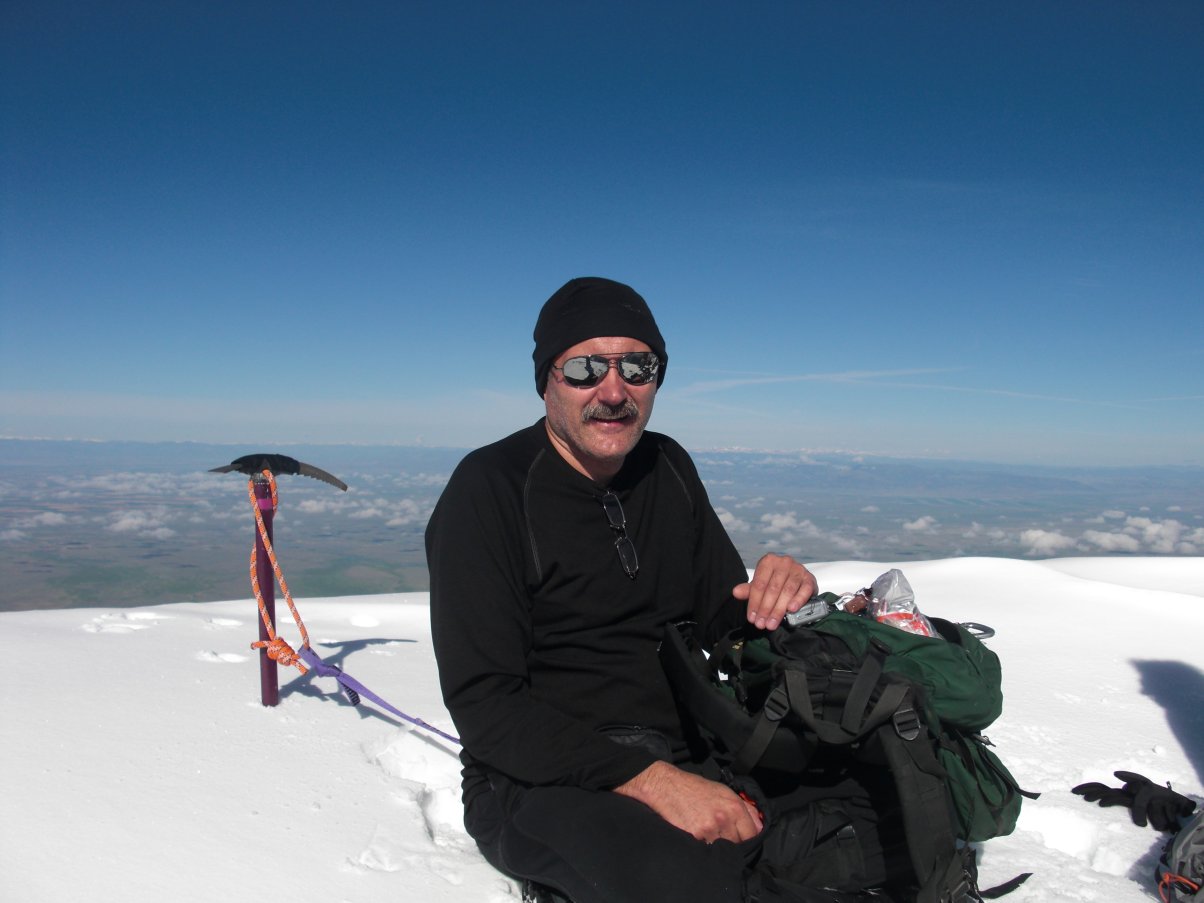
Me on Mount Rainier
Click Here for my YouTube video of 75 Year Old Woman Who Climbed Whitney (via the 211 mile John Muir Trail) ALL ALONE!
14er Waypoints

For personal safety, and just for the fun of it, I usually take a GPS "reading" on the top of each peak, at the trailhead, or some other interesting point or curiosity along the way. WARNING: I cannot guarantee the accuracy of these waypoints as my own GPS bounces around a lot or I simply take an incorrect reading! Please rely on a more accurate source for your Waypoints! That being said, I still enjoy "cataloging" Waypoints and I keep a bunch of other locations, from around the world, on my 12ers 13ers, Hiking, Waypoints, and other pages...
|
|
* Cameron, Challenger Point, Conundrum Peak, North Eolus, and North Maroon are not "official" 14ers but well worth stopping by if you're in the area!
Some Trailheads:

Mount Evans Wilderness, Colorado
South Colony Lakes (for the Crestones and Humboldt) N 37° 57.848' W 105° 33.759' 11,745 feet 3,580 metres Capitol Lake campsite #8 (as of 08-09-2009) N 39° 09.954' W 107° 04.977' 11,622 feet 3,542 metres Capitol Creek Trailhead (For Capitol Peak) N 39° 14.055' W 107° 04.842' 9,532 feet 2,905 metres Navajo Lake (for the Wilsons and El Diente) N 37° 50.858' W 108° 01.669' 11,154 feet 3,399 metres Woods Lake (to Navajo Lake for the Wilsons and El Diente ) N 37° 53.043' W 108° 03.211' 9,429 feet 2,874 metres Needleton train stop at the Animas River (for access to Chicago Basin) N 37° 38.014' W 107° 41.569' 8,160 feet 2,487 metres Shavano + Tabeguache trailhead (parking lot at restroom) N 38° 35.800' W 106° 11.822' 9,564 feet 2,915 metres Matterhorn Creek trailhead (for Wetterhorn Peak) N 38° 01.863' W 107° 29.472' 10,836 feet 3,303 metres Bakerville at I-70 (My favorite starting point for Grays and Torreys!) N 39° 41.472' W 105° 48.289' 9,842 feet 3,014 metres Grays and Torreys parking lot N 39° 39.652' W 105° 47.060' 11,251 feet 3,429 metres Maroon Lake N 35° 05.919' W 106° 56.406' 9,580 feet 2,920 metres
What is a "Fourteener"?
In their book, Rocks Above The Clouds (pp. 12-13) authors Jack Reed and Gene Ellis state; "Colorado peaks with summits higher than 14,000 feet are commonly referred to as 'Fourteeners'. But how many of them are there? Various guidebooks give various numbers, depending on how each particular author chooses to define a separate peak. In 1968, in an article in Trail & Timberline (the magazine of The Colorado Mountain Club), William Graves suggested that to be considered a separate Fourteener a peak should be separated from a neighboring Fourteener by a saddle that is at least 300 feet lower than the summit of the lower peak." "When the rule was proposed, modern topographic survys had not yet been completed. When the surveys were finished in the 1970s, it was discovered that North Maroon Peak and El Diente, both of which had traditionally been considered separate peaks, failed to meet the 300-foot criterion. However, out of respect for tradition, they continuied to be included in most Fourteener lists, bringing the total number of Fourteenrs to 54."
Prominence, a Definition:
In topography, "prominence" is the height of a mountain or hill's summit by the vertical distance between it and the lowest contour line encircling it and no higher summit - Prominence is a measure of the independence of a summit. Only summits with a sufficient degree of prominence are regarded as independent mountains. For example, the world's second-highest mountain is K2 (height 8,611 metres, prominence 4,017 metres). While Mount Everest's South Summit (height 8,749 metres, prominence about 10 metres) is taller than K2, it is not considered an independent mountain because it is a subsummit of the main summit (which has a height and prominence of 8,848 metres).
Measuring Elevation:
On March 26, 2019 I received this interesting note from
92 year old Jan Waddington (posted with her permission):
To whom it may concern,
I have looked in all four of my copies of Ormes -14er books, noting especially the changing height listed for Mt. of the Holy Cross. In the 1952 edition, there it was 13,996 ft., just as I remembered from the great disappointment when the altimeter group from the Univ. of Colo. Hiking Club returned and the results were determined. (I was a member of some of those trips, the heavy altimeter being carried to the top of likely 14ers.)
Yet in recent editions of "Ormes", with no explanation in any edition I have, Mt. of the Holy Cross is 14,005 ft! Amazing! So a search began to find the reason, soon noting that all the peaks had changed over the years.
Finally, by contacting a friend/retiree from USGS this answer arrived.
"The difference in elevation is due to the way the height above ground is measured, not any change in the height of the mountain (we knew that). The 13,996 height is elevation above mean sea level using the NGVD29 which used mean sea level as the base 0 elevation point. The 14,005 feet came from NAVD88 which uses a mathematical model of the earth (a geoid) to determine elevation."
So, I needed to share, thinking that surely some other CMC members have also wondered about these changes in altitude of our 14ers, most especially anyone involved in a new edition of the 14er book.
Sincerely,
Jan Waddington (on/off member since the 1950s)
First person to spend the night on the top of all of Colorado's 14ers!
Me and Jon Kedrowski at the CMC office in Golden, ColoradoDr. Jon Kedrowski (the guy on my left) became the first person to camp and spend the night on the top of Colorado's 55 official 14ers (peaks over 4,267 metres / 14,000 feet). He achieved the feat from June 23 to September 28 2011, a stretch of only 95 days from start to finish. Jon is also an author, ski-mountaineer, and geographer, and had climbe Mount Everest a half dozen years before I had met him...
Frozen 14ers:
Here's part of an email exchange I had
with John Balciar on April 3rd, 2020:
The reason I asked the questions I did is because I just finished the fourteeners in Winter which also completed the Seasonal Grid for me. Friends ask if I am the to complete the Seasonal grid, but I always answer that there are rumors that someone else has, but it is not known for sure. There is currently an accepted list of Winter finishers, but of course there always seems to be people who know of additions to the list but no names are ever mentioned. Kind of like the CMC knowing of 1800 14er finishers, but there is probably closer to 5000!Seasonal Grid Finisher: (list of 59)
I never got a chance to climb with Steve Gladbach, wish I had. I guess I overlooked him as a candidate for being a Seasonal grid finisher because his 14ers.com checklist only had 3 climbs of Conundrum. Of course, Steve could have completed the list of 53 or 54 in each of the 4 seasons rather than the current standard of 58 or 59 (with N. Massive). Ever since Aron Ralston became the 3rd Winter finisher and for some reason added N. Massive, every winter finisher since has been using the list of 59, including Steve. Sorry, too much rambling.
Anyway, here is some information that may interest you. The current accepted list of Colorado Winter 14er finishers (or Frozen 14er Finishers) is: (what I mean by accepted is that it will pop up on the 14ers.com forum discussions every year Winter rolls around)
- Tom Mereness 1976-1992
- Jim Bock 1984-1997
- Aron Ralston 1997-2005
- Steve Gladbach 1988-2011
- Sarah Meiser 2014
- Mike Silvestro 2016
- Dwight Sunwall 2016
- Dominic Meiser 2016
- Jeff Heiderer 2017
- Jim Yaich 2017
- Greg Gorrell 2017
- John Prater 2017
- Will Seeber 2018
- Andrew Hamilton 2018
- Amy Gray 2020
- Derek Wolfe 2020
- John Balciar 2020
Monthly Grid: (696 list of 58x12)
- John Balciar 2020
Top 5 current as of 4-3-2020 taken from ListsofJohn.com (of course this is only people thatOther Stats:
use this website. I don't know of other resources that might have an accurate count for anyone
else but Ken is definitely publicly recognized as the leader in monthly grid progress.)
- Ken Nolan 558
- John Balciar 456
- John Prater 384
- Brad McQueen 322
- Jean Aschenbrenner 266
Another 14er stat that I think is pretty noteworthy is that Jim Gehres has climbed all the Colorado 14ers at least 12 times! (documented in the press and mentioned in a couple of Walter Borneman books)
Thanks again for your prompt response and providing the opportunity to browse your website. If at sometime it works out to do more research at the library, I might contact you. But I am happy enough with your answer thinking Steve had already accomplished the seasonal grid project I can never get enough Colorado mountain discussion and history!
Thanks,
John
Is it fourteener season yet in Colorado? Almost.
Experts warn traversing snowfields without proper gear is risky; Colorado Mountain Club recommends waiting until July.
By John Meyer, The Denver Post Jun 19, 2021, 6:00 am
"'Somewhere along the line, the fourteeners went from being mountaineering objectives to being hiking destinations,' Athearn said Athearn said [Lloyd Athearn, executive director of Colorado Fourteeners Initiative]. 'I think there is a big difference between those two terms. From year to year, the mountains can still be very much mountaineering objectives in June if they've got snow. It only takes one small patch of icy snow in the wrong place - you're trying to cross it, you slip and fall and end up in a talus field. Or worse.'"
"That's why the Colorado Mountain Club typically recommends casual hikers wait until July, and they're holding to that advice this year despite Colorado’s recent heat wave and rapid snowmelt."
"'Traveling through snow, especially on a steep slope, can be hazardous,' said CMC membership specialist Roger Wendell. 'Post-holing - punching your foot and your leg into the snow, sometimes up to your hip - can be exhausting. But if things froze over or were hard-packed, and you're not prepared - if you don't have crampons, or you don't know how to use an ice axe - you can slide. You could get seriously hurt, if not killed.'"
|
|
Click Here for red, pink, and "Watermelon Snow" at the bottom of my Snow Day page... |
|
|
Click Here for Steve Hoffmeyer's 14er gallery |
Yosemite Decimal System
The Yosemite Decimal System (YDS) is a three-part system used for rating the difficulty of hikes and climbs. YDS is primarily used by mountaineers in the United States and Canada. However, there are many different rating systems used around the world. Examples include the British trad grade, the French sport grade, and the International Climbing and Mountaineering Federation's (UIAA) alpine grade. As for the YDS, it was first devised by members of the Sierra Club in Southern California in the 1950s. YDS was a refinement of earlier systems, particularly those developed in Yosemite Valley.Class 1: Hiking on a trail.
Classification of climbs can vary quite a bit depending on location and history. Indoor gym ratings tend to be inflated compared to outdoor ratings. Ratings tend to be lower in outdoor areas where climbing routes were developed in earlier years. Guidebooks have often raised the ratings on older climbs to make them more comparable to newer ratings. The YDS grade system also involves an optional Roman numeral grade that indicates the length and seriousness of the route. The grades are:
| Grade | Duration |
|---|---|
| I | One to two hours of climbing |
| II | Less than half a day |
| III | Half a day climb |
| IV | Full day climb |
| V | A climb lasting 2–3 days |
| VI | A climb lasting 4–6 days |
| VII | A climb lasting a week or longer |
Links:
North America's highest auto road is on a 14er!
| Warning! Climbing, mountaineering, and backcountry skiing are dangerous and can seriously injure or kill you. By further exploring this website you acknowledge that the information presented here may be out of date or incorrect, and you agree not to hold the author responsible for any damages, injuries, or death arising from any use of this resource. Please thoroughly investigate any mountain before attempting to climb it, and do not substitute this web site for experience, training, and recognizing your limitations! |
 Back to Roger J. Wendell's Home Page...
Abbey |
About |
Blog |
Contacting
Me |
Copyright |
Disclaimer |
Donate |
Guest
Book |
Home |
Links |
Site
Index |
Solutions |
Terms,
Conditions
and
Fair
Use |
What's
Changed
or
New?
Copyright
© 1955 -


 1993 - Elevation 14,268 feet")
 - 07-12-2008")


